
Winter Storm Watch Issued for North and Central Alabama
Dangerous Conditions Possible This Weekend
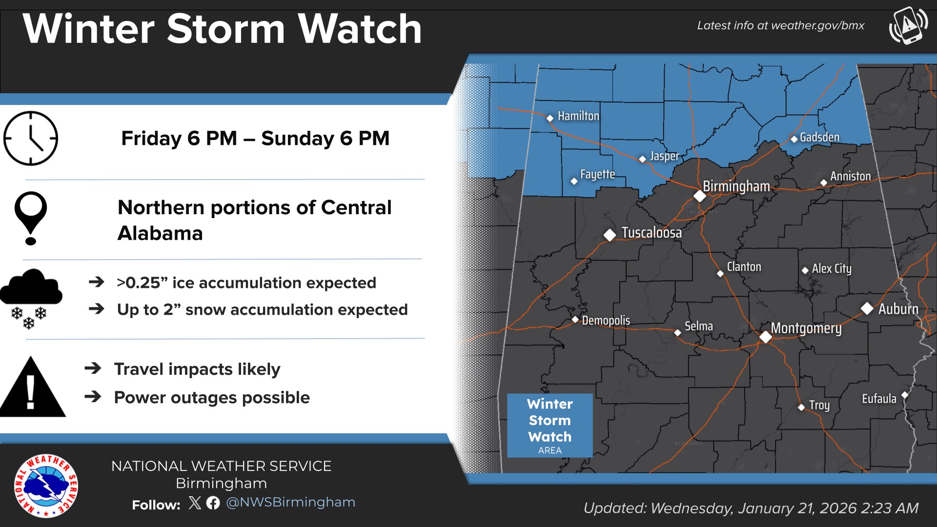
A Winter Storm Watch has been issued for portions of north and central Alabama and will be in effect from Friday evening through Sunday afternoon, according to forecasters.
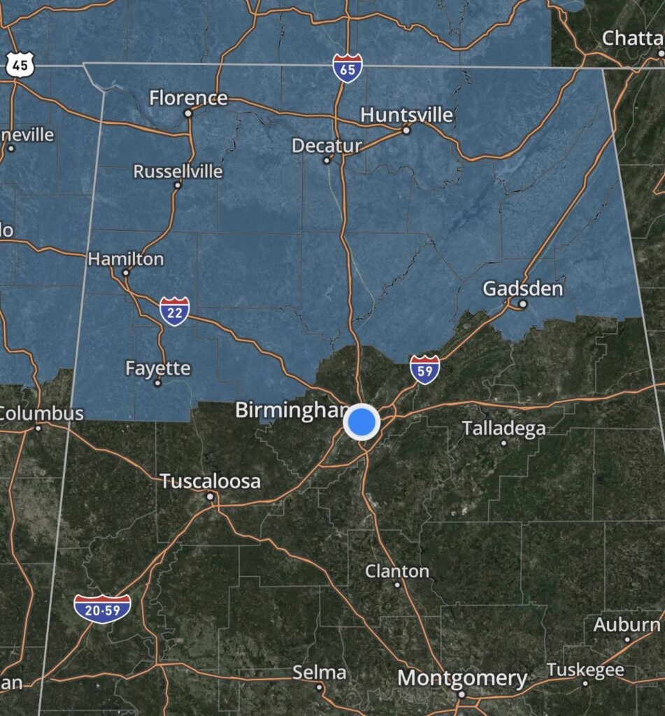
The watch includes Blount, Cherokee, Etowah, Fayette, Lamar, Marion, Walker, and Winston counties.
Meteorologists warn that heavy mixed precipitation is possible during the event, including significant ice accumulation. Ice totals could exceed one-quarter inch, with snow and sleet accumulations of up to two inches also possible in some areas.
Officials say the primary concern is ice, which could lead to widespread and prolonged power outages, potentially lasting more than a day, along with extensive tree damage. Travel conditions could become extremely hazardous or even impossible at times.
Emergency management officials urge residents to closely monitor the latest forecasts as the situation develops and to take preparedness steps now rather than waiting until conditions worsen. Stay tuned to WEIS Radio before and during the event for all the latest information. Be sure to have a battery operated radio, and plenty of batteries.
Authorities strongly recommend delaying all travel during the storm. If travel is absolutely necessary, drivers are advised to proceed with extreme caution and carry a winter storm emergency kit. Recommended items include tire chains, booster cables, a flashlight, a shovel, blankets, extra clothing, water, a first-aid kit, and other supplies needed in case of becoming stranded.
Local officials are advising residents to be prepared to remain in their homes for up to five days, possibly without electricity. They recommend having adequate food, water, medications, extra blankets, and general safety and emergency supplies on hand by Friday evening.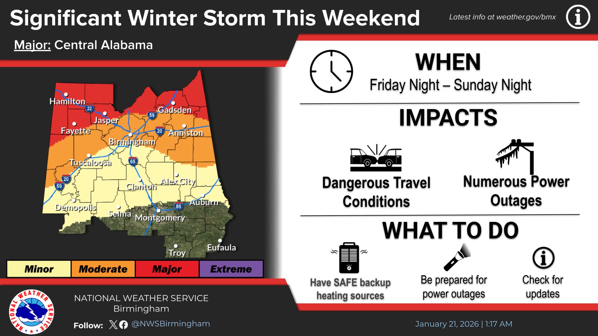
Residents who rely on electrically powered medical equipment are urged to have a contingency plan in place in the event of extended power outages. Pet owners should also ensure they have sufficient food and supplies and a plan to keep animals safe during the storm.
Authorities also encourage residents to check on neighbors, particularly the elderly and those with medical needs, before and during the storm.
Officials emphasize that this storm has the potential to be serious and encourage everyone in the affected areas to take preparation efforts seriously and act now.
From the National Weather Service in Birmingham:
URGENT – WINTER WEATHER MESSAGE
National Weather Service Birmingham AL
208 AM CST Wed Jan 21 2026
Marion-Lamar-Fayette-Winston-Walker-Blount-Etowah-Cherokee-Including the cities of Hamilton, Oneonta, Centre, Double Springs, Fayette, Jasper, Gadsden, Vernon, and Sulligent
…WINTER STORM WATCH IN EFFECT FROM FRIDAY EVENING THROUGH SUNDAY AFTERNOON…
* WHAT…Heavy mixed precipitation possible. Ice accumulation above one quarter inch. Snow and sleet accumulations up to 2 inches possible.
* WHERE…Blount, Cherokee, Etowah, Fayette, Lamar, Marion, Walker, and Winston Counties.
* WHEN…From Friday evening through Sunday afternoon.
* IMPACTS…Expect power outages that last more than a day and extensive tree damage due to the ice. Travel could be impossible.
PRECAUTIONARY/PREPAREDNESS ACTIONS…
Monitor the latest forecasts for updates on this situation.
Persons should consider delaying all travel. If travel is absolutely necessary, drive with extreme caution. Consider taking a winter storm kit along with you, including such items as tire chains, booster cables, flashlight, shovel, blankets and extra clothing. Also take water, a first aid kit, and anything else that would help you survive in case you become stranded.
From the National Weather Service in Huntsville:
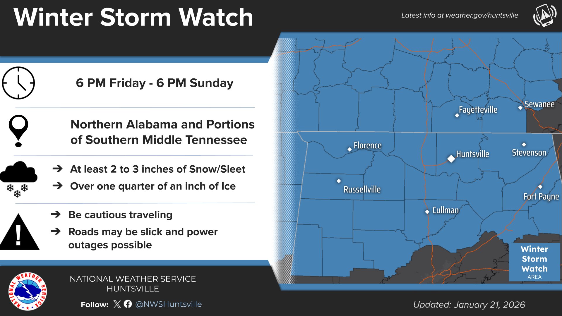
URGENT – WINTER WEATHER MESSAGE
National Weather Service Huntsville AL
215 AM CST Wed Jan 21 2026
Lauderdale-Colbert-Franklin AL-Lawrence-Limestone-Madison-Morgan- Marshall-Jackson-DeKalb-Cullman-Moore-Lincoln-Franklin TN-Including the cities of Cowan, Scottsboro, Sheffield, Fort Payne, Florence, Huntsville, Russellville, Decatur, Albertville, Estill Springs, Moulton, Sewanee, Red Bay, Lynchburg, Athens, Winchester, Boaz, Arab, Guntersville, Fayetteville, Rainsville, Town Creek, Tuscumbia, Cullman, Muscle Shoals, and Decherd
…WINTER STORM WATCH IN EFFECT FROM FRIDAY EVENING THROUGH SUNDAYAFTERNOON…
* WHAT…Moderate to heavy accumulations of snow, sleet, or ice are expected Friday night through Saturday night. Snow and sleet accumulations of at least 2 to 3 inches. Ice accumulations above one quarter of an inch. Locally higher amounts possible.
* WHERE…Portions of north central, northeast, and northwest Alabama and southern middle Tennessee.
* WHEN…From Friday evening through Sunday afternoon.
* IMPACTS…Expect power outages and tree damage due to ice accumulations. Travel could be impossible.
PRECAUTIONARY/PREPAREDNESS ACTIONS…
Persons should consider delaying all travel. If travel is absolutely necessary, drive with extreme caution. Consider taking a winter storm kit along with you, including such items as tire chains, booster cables, flashlight, shovel, blankets and extra clothing. Also take water, a first aid kit, and anything else that would help you survive in case you become stranded.


You must be logged in to post a comment.