
Flood Advisory
National Weather Service Birmingham AL
434 PM CDT Fri Jul 3 2026
…FLOOD ADVISORY IN EFFECT UNTIL 745 PM CDT THIS EVENING…
* WHAT…Urban and small stream flooding caused by excessive rainfall is expected.
* WHERE…A portion of central Alabama, including the following county, Cherokee.
* WHEN…Until 745 PM CDT.
* IMPACTS…Minor flooding in low-lying and poor drainage areas. River or stream flows are elevated.
* ADDITIONAL DETAILS…
– At 434 PM CDT, Doppler radar indicated heavy rain due to thunderstorms. This will cause urban and small stream flooding.
– Some locations that will experience flooding include…
Centre, Cedar Bluff, Centre Municipal Airport, Forney, Leesburg, Gaylesville, Moshat, Eastern Weiss Lake, Tennala, Cornwall Furnace Park, Western Weiss Lake, Pleasant Gap, Ball Flat, Coloma, Howells Crossroads, Waterhouse, Chesnut Bay Resort, Spring Garden and Weiss Dam.
PRECAUTIONARY/PREPAREDNESS ACTIONS…
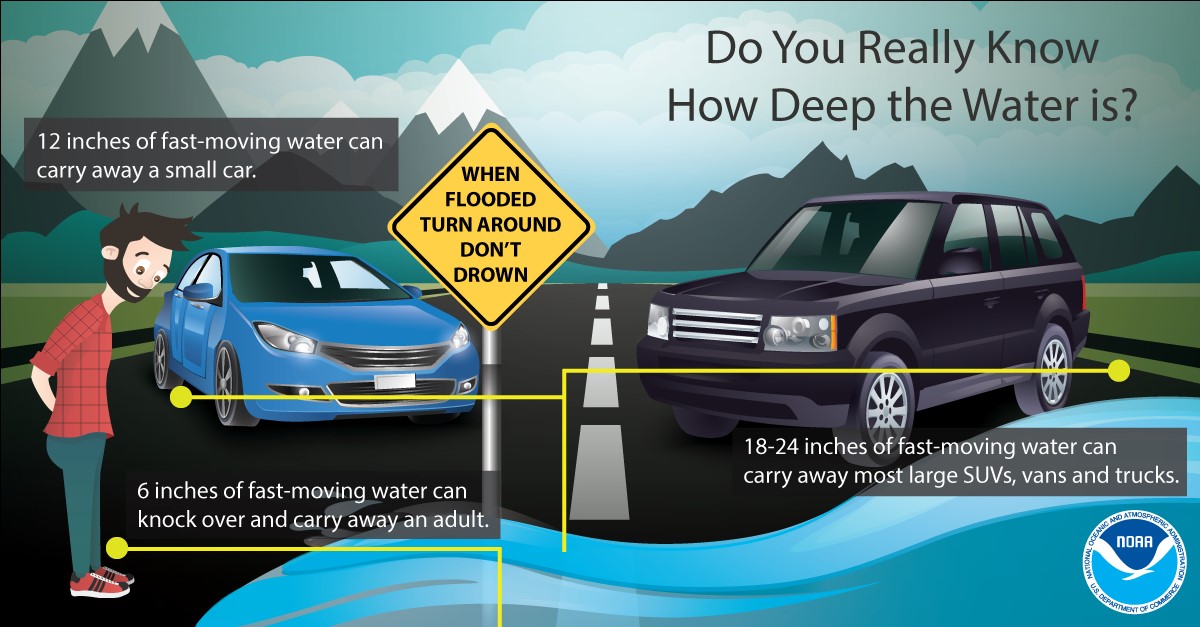
Turn around, don`t drown when encountering flooded roads. Most flood deaths occur in vehicles.
Flooding is occurring or is imminent. It is important to know where you are relative to streams, rivers, or creeks which can become killers in heavy rains. Campers and hikers should avoid streams or creeks.


You must be logged in to post a comment.