
From the National Weather Service in Birmingham:
Flood Watch
National Weather Service Birmingham AL
309 AM CDT Mon Jun 8 2026
Blount-Etowah-Calhoun-Cherokee-Cleburne-Jefferson-Shelby-St.
Clair-Talladega-Including the cities of Anniston, Talladega, Moody, Columbiana, Birmingham, Centre, Oneonta, Heflin, Gadsden, Hoover, Pell City, Alabaster, Pelham, and Sylacauga
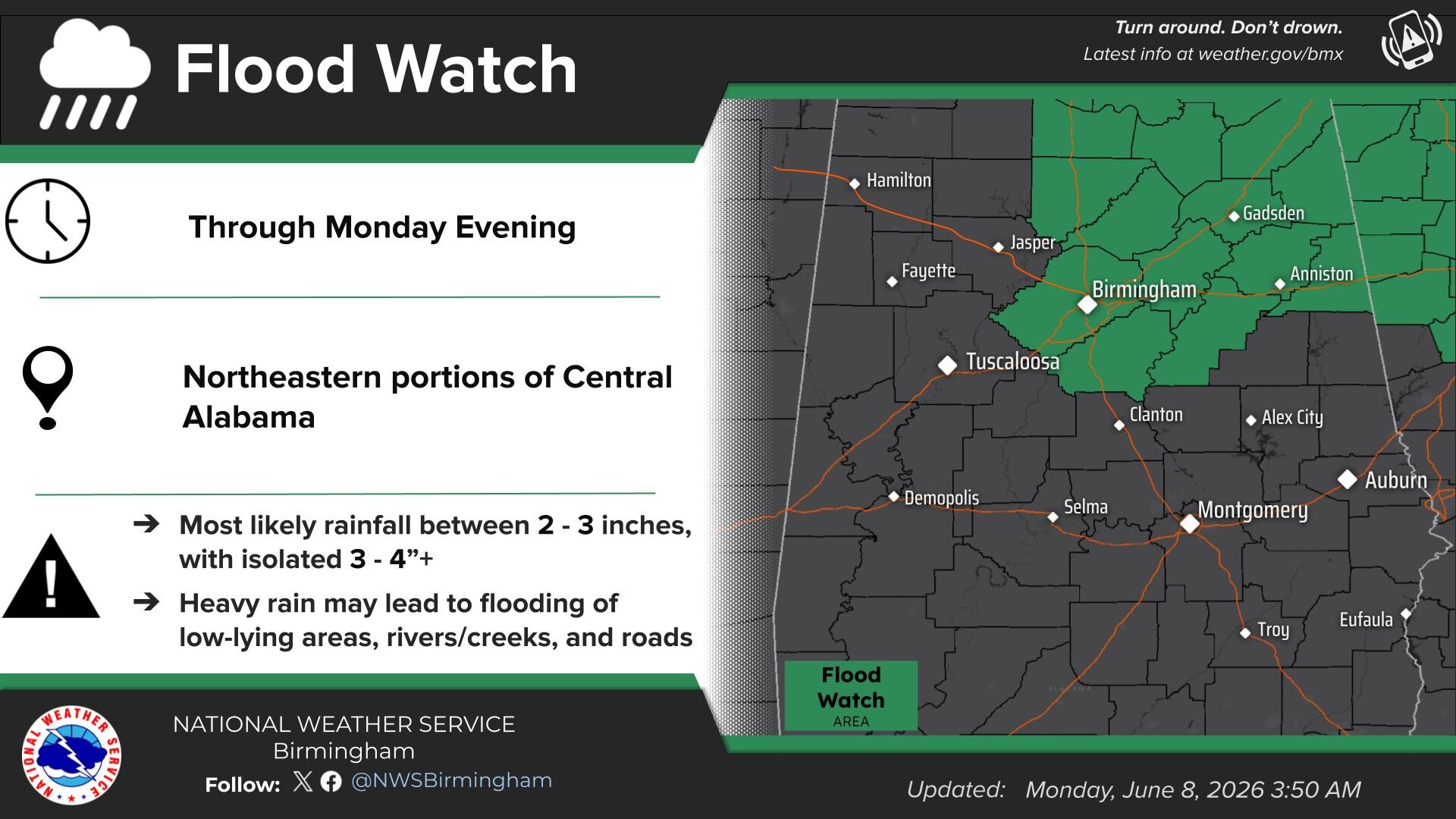
…FLOOD WATCH IN EFFECT FROM 7 AM CDT THIS MORNING THROUGH THIS EVENING…
* WHAT…Flooding caused by excessive rainfall is possible.
* WHERE…A portion of central Alabama, including the following counties, Blount, Calhoun, Cherokee, Cleburne, Etowah, Jefferson, Shelby, St. Clair and Talladega.
* WHEN…From 7 AM CDT this morning through this evening.
* IMPACTS…Excessive runoff may result in flooding of rivers, creeks, streams, and other low-lying and flood-prone locations. Flooding may occur in poor drainage and urban areas.
* ADDITIONAL DETAILS…
– http://www.weather.gov/safety/flood
PRECAUTIONARY/PREPAREDNESS ACTIONS…
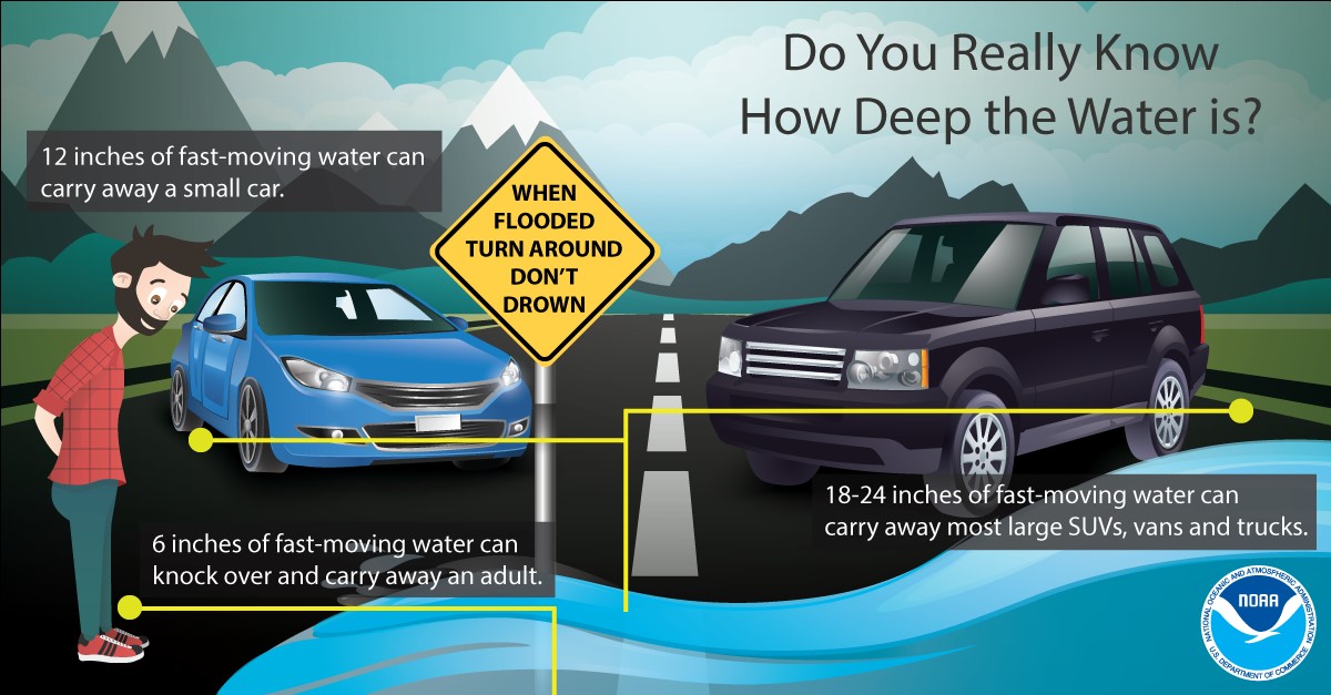
You should monitor later forecasts and be alert for possible Flood Warnings. Those living in areas prone to flooding should be prepared to take action should flooding develop.
From the National Weather Service in Huntsville:
Flood Watch
National Weather Service Huntsville AL
735 AM CDT Mon Jun 8 2026
Lauderdale-Limestone-Madison-Morgan-Marshall-Jackson-DeKalb-Cullman-Moore-Lincoln-Franklin TN-Including the cities of Albertville, Cowan, Decherd, Huntsville, Fayetteville, Athens, Lynchburg, Estill Springs, Fort Payne, Scottsboro, Winchester, Boaz, Rainsville, Decatur, Arab, Florence, Guntersville, Sewanee, and Cullman
…POTENTIAL FOR CONSIDERABLE AND LIFE THREATENING FLOODING…
* WHAT…Flooding caused by excessive rainfall remains in the forecast today.
* WHERE…Portions of Alabama, including the following areas, Cullman, DeKalb, Jackson, Lauderdale, Limestone, Madison, Marshall and Morgan and southern middle Tennessee, including the following areas, Franklin TN, Lincoln and Moore.
* WHEN…Through this evening.
* IMPACTS…Excessive runoff may result in flooding of rivers, creeks, streams, and other low-lying and flood-prone locations. Creeks and streams may rise out of their banks. Flooding may occur in poor drainage and urban areas. Those living in areas prone to flooding should be prepared to take action should flooding develop.
* ADDITIONAL DETAILS…
– Northeast Madison county and most of Jackson County in Alabama received 7-8 inches of rainfall yesterday. Elsewhere,
3-5 inches of rain fell in the watch area. Additional rainfall today will worsen flood conditions. Due to saturated soils, additional rainfall today will be almost entirely runoff. Widespread totals up to 1-2 inches are forecast, but the potential for bullseyes of 4-6 inches introduces the considerable flooding threat.
– http://www.weather.gov/safety/flood
PRECAUTIONARY/PREPAREDNESS ACTIONS…
You should monitor later forecasts and be alert for possible Flood Warnings. Those living in areas prone to flooding should be prepared to take action should flooding develop.
Stay with WEIS 100.5 FM, 990 AM, and the WEIS Radio app for the latest weather updates!


You must be logged in to post a comment.