
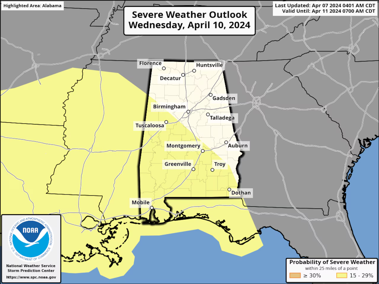
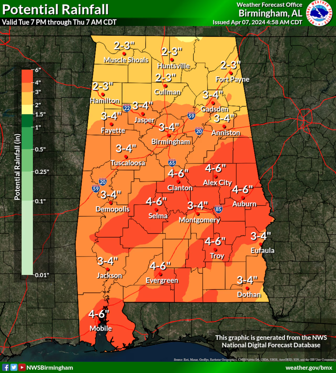
Several rounds of storms are in the forecast – for at least part of Alabama this week, and a lot of rain – possibly up to 6 inches for some areas – that is according to the National Weather Service. The best chance for storms in Alabama will arrive Wednesday afternoon, and last into Wednesday night. A tornado, damaging winds and heavy rainfall will all be possible, mainly for areas in south and west Alabama. Strong to severe storms will be possible Wednesday – mainly during the afternoon into that night, according to the most up-to-date data.
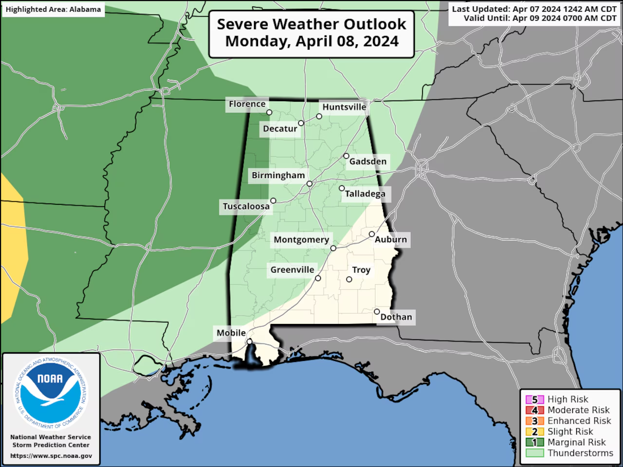
According to the Storm Prediction Center – isolated severe storms could also affect parts of north and west Alabama, Monday. The SPC has added a Level 1 out of 5 (or “marginal”) risk for the areas, to the Monday severe weather outlook. North Alabama is forecast to receive less rainfall than the southern areas of the state – but could also get 2 to 3 inches before it’s over, according to forecasters. The Weather Prediction Center has MOST of Alabama – included in a risk for Flash Flooding from Wednesday into Thursday:
There IS some good news – things are looking drier and sunnier, for next weekend – according to forecasters.


You must be logged in to post a comment.