

A disturbance from the Gulf of Mexico is causing the rain over parts of Alabama on Monday. And there could be a few strong storms today as well.
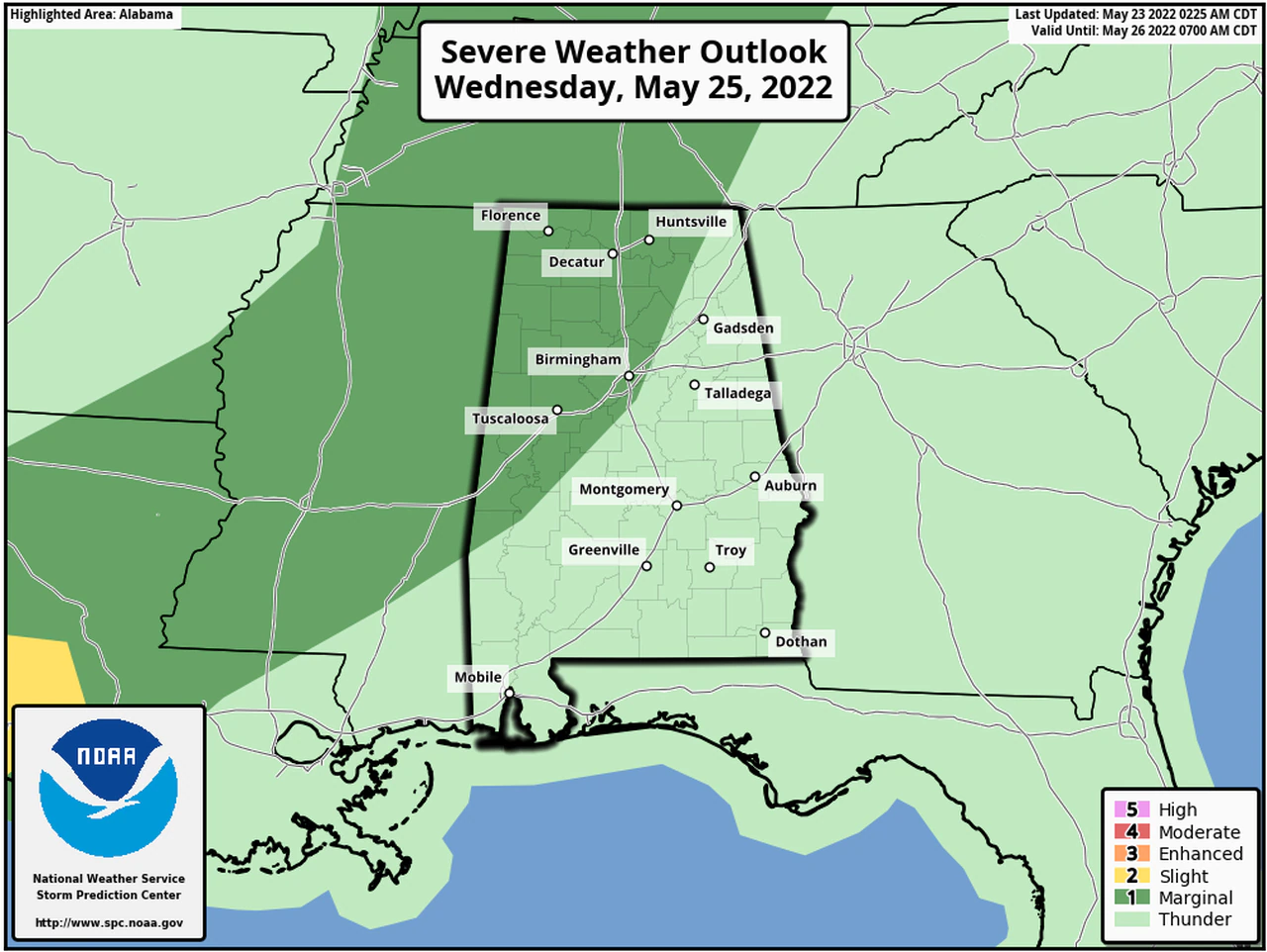
The Storm Prediction Center has the southeastern part of Alabama in a Level 1 out of 5 risk for severe weather today. A Level 1 risk is marginal and means that isolated severe storms will be possible. The strongest storms could have damaging wind gusts and hail. Today won’t be the only chance for storms this week with another round of strong to severe storms possible Wednesday into Thursday.
A shield of rain and embedded storms associated with an area of low pressure was moving across parts of central and eastern Alabama on Monday morning. That system originated in the Caribbean and had gotten the National Hurricane Center’s attention over the weekend. It moved inland overnight over the Florida Panhandle near Pensacola but is continuing to bring a soaking rain to parts of the state. Counties in the wind advisory could experience wind gusts up to 40 mph, according to the weather service.
The hurricane center said the system has no chance, now that it’s inland, of developing further. But it could continue to bring heavy rain and gusty winds to parts of Alabama through the day today as its center tracks roughly along the Interstate 59 corridor. There is also a cold front lurking in the region, and it could help keep rain chances high for parts of Alabama on Tuesday and into Wednesday, according to forecasters.
However, there is no severe weather risk for Alabama on Tuesday.
That will change on Wednesday as the next weather system approaches.
Strong to severe storms again will be possible on Wednesday into Thursday and could include damaging winds, hail and heavy rain. The tornado threat this time around will be low but not zero, according to the weather service.


You must be logged in to post a comment.