

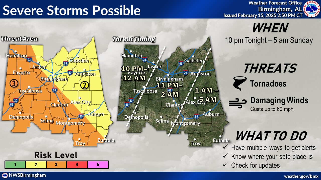
From Birmingham National Weather Service Office-Hazardous Weather Outlook for Tonight
Severe Weather Risk Tonight through Early Sunday Morning
A line of strong to severe storms will move across Central Alabama tonight
through early Sunday morning.
○There is a Low to Medium risk for severe storms (Level 2 to 3 of 5).
■ Damaging straight-line winds up to 60 mph
■ Tornadoes are possible.
- There is a Low risk for localized flooding due to already saturated ground conditions from previous rainfall.
○ The System will be fast-moving, which will limit chances for significant flooding.
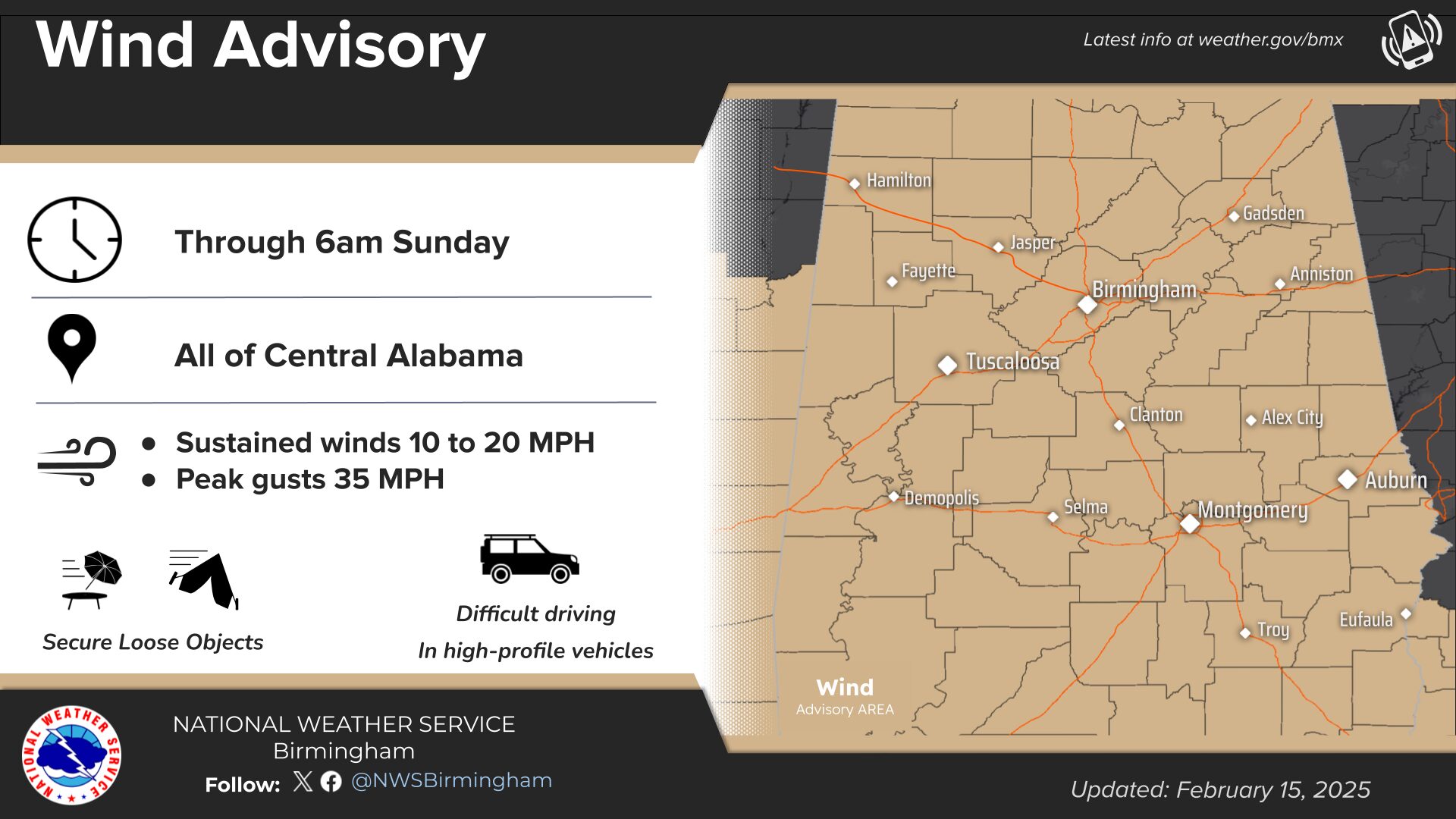
A wind advisory is in effect overnight until 6am Sunday with winds 15 to 35 miles per hour.
Pay Close Attention to Developing Weather Overnight.


You must be logged in to post a comment.