
BIRMINGHAM — The National Weather Service in Birmingham is forecasting an extended period of unsettled weather across Central Alabama, with repeated chances for showers and thunderstorms expected through Saturday.
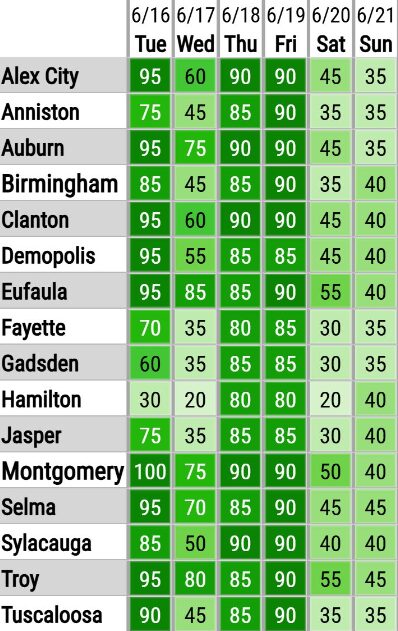
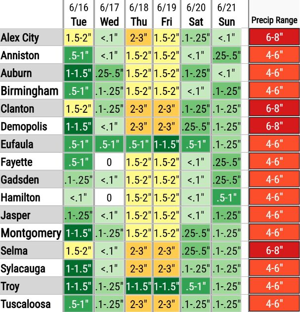
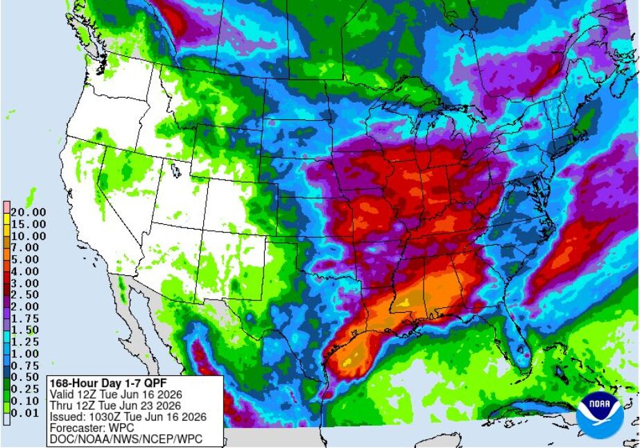
Forecasters say rain chances will remain in the medium to high range throughout the week, bringing the potential for significant rainfall accumulations in some areas.
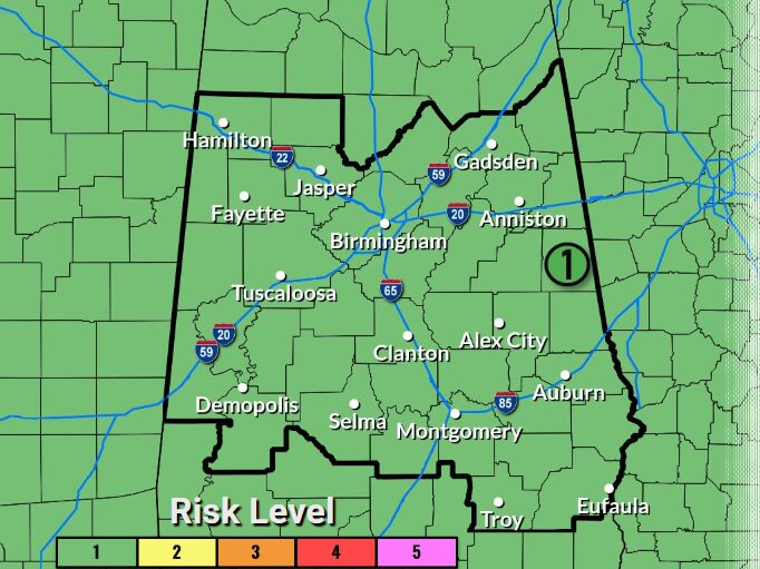
In addition to the heavy rain threat, a Marginal Risk, or Level 1 out of 5, for severe weather has been issued for Thursday across all of Central Alabama. The primary threats associated with any stronger storms will be damaging wind gusts and the possibility of a brief tornado.
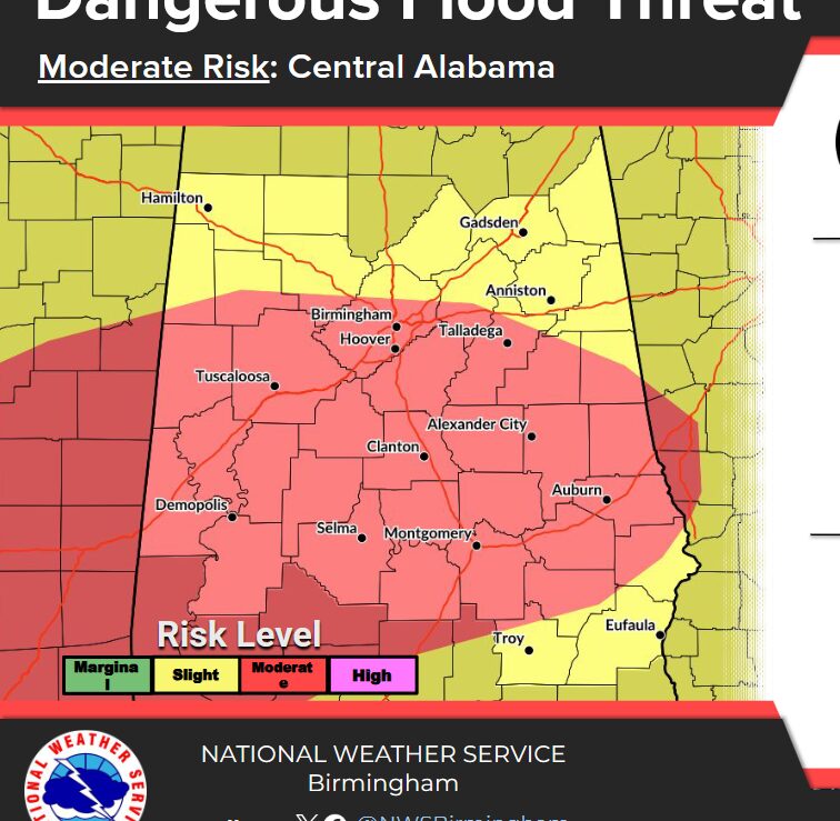
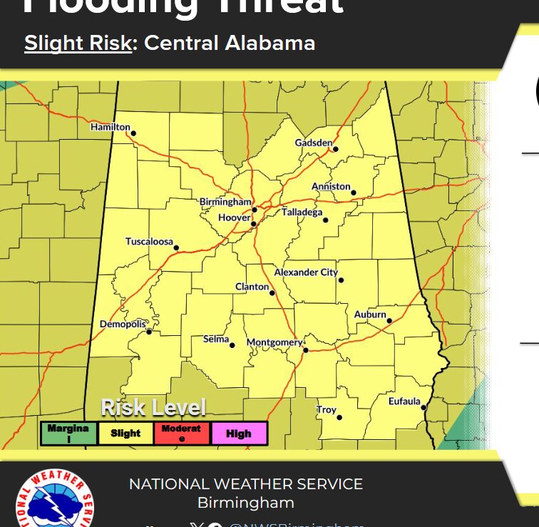
Meteorologists are also monitoring increasing concerns about flooding as soils become saturated from repeated rounds of rainfall. Rising water levels on streams, rivers, and lakes are expected to become a growing concern late this week and continue through the upcoming weekend.
The National Weather Service encourages residents to stay informed of changing weather conditions and monitor forecasts for updates as the situation develops. Those living in flood-prone areas should remain alert for possible flood advisories, watches, or warnings in the coming days.


You must be logged in to post a comment.