
National Weather Service Updates Severe Weather Outlook for Wednesday Night into Thursday
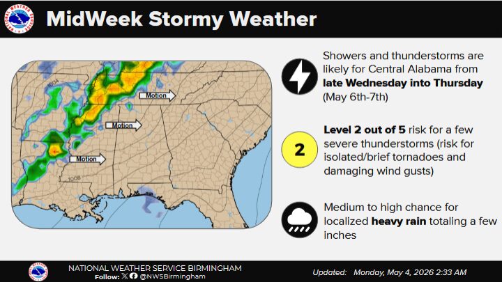
The National Weather Service in Birmingham has released an updated forecast indicating a continued risk for severe thunderstorms across the region from late Wednesday night into early Thursday morning, May 6th into May 7th.
Forecasters report a slight adjustment to the severe weather outlook, with the Level 2 risk area marginally refined and surrounding areas now included under a Level 1 risk designation. The overall threat remains in the low to moderate range on a five-level scale.
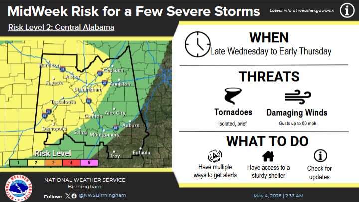
According to meteorologists, the primary window for potential severe weather will be during the late evening hours Wednesday through the early morning hours Thursday. A few strong to severe thunderstorms are possible during this period.
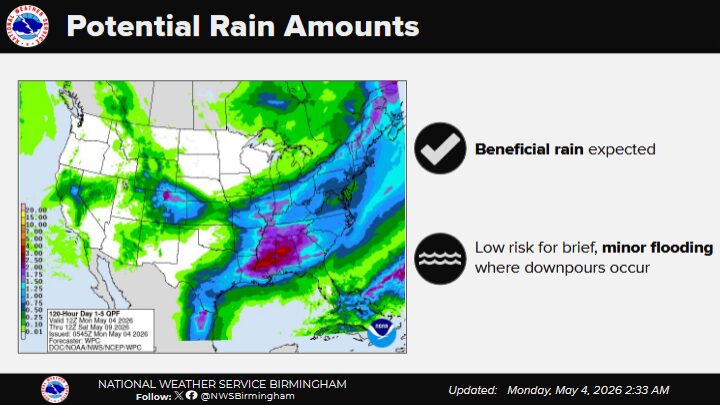
The main hazards include isolated, brief tornadoes and damaging wind gusts capable of producing localized damage. In addition, periods of heavy rainfall are expected, which may provide beneficial moisture but could also result in brief, minor flooding in low-lying or poorly drained areas.
Officials emphasize that while widespread severe weather is not expected, residents should remain weather-aware and ensure they have multiple ways to receive warnings, particularly overnight when storms could develop or move through the region.
The National Weather Service will continue to monitor conditions and provide updates as the system approaches.


You must be logged in to post a comment.