
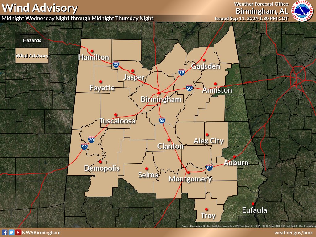
The National Weather Service in Birmingham has issued a wind advisory for most of Central Alabama, including Cherokee, Calhoun, and Etowah Counties.
…WIND ADVISORY IN EFFECT FROM MIDNIGHT TONIGHT TO MIDNIGHT CDT THURSDAY NIGHT…
* WHAT…East winds 15 to 25 mph with gusts up to 40 mph expected.
* WHERE…Autauga, Bibb, Blount, Bullock, Calhoun, Cherokee, Chilton, Clay, Coosa, Dallas, Elmore, Etowah, Fayette, Greene, Hale, Jefferson, Lamar, Lowndes, Macon, Marengo, Marion, Montgomery, Perry, Pickens, Pike, Shelby, St. Clair, Sumter, Talladega, Tallapoosa, Tuscaloosa, Walker, and Winston Counties.
* WHEN…From midnight tonight to midnight CDT Thursday Night.
* IMPACTS…Gusty winds will blow around unsecured objects. Trees could be blown down and a few power outages may result.
PRECAUTIONARY/PREPAREDNESS ACTIONS…
Winds this strong can make driving difficult, especially for high profile vehicles. Use extra caution.
Secure outdoor objects.
Stay with WEIS 100.5 FM & 990 AM for all the latest weather updates.
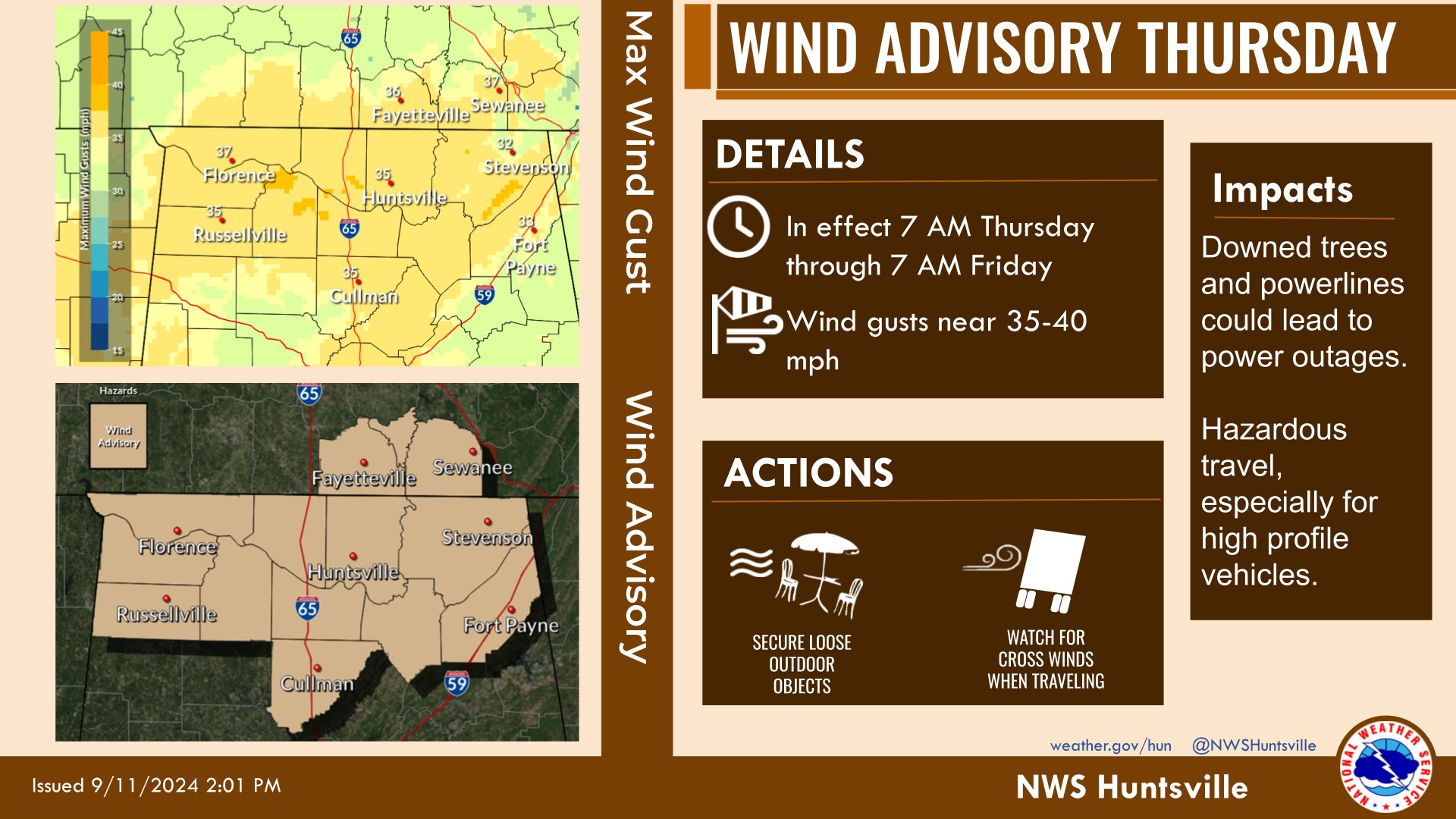
A wind advisory has also been issued by the National Weather Service in Huntsville for the Tennessee Valley area, including DeKalb and Marshal Counties.
…WIND ADVISORY IN EFFECT FROM 7 AM THURSDAY TO 7 AM CDT FRIDAY…
* WHAT…Southeast winds 15 to 25 mph with gusts up to 35 mph expected.
* WHERE…North Alabama and portions of southern middle Tennessee.
* WHEN…From 7 AM Thursday to 7 AM CDT Friday.
* IMPACTS…Gusty winds will blow around unsecured objects. Tree limbs could be blown down and a few power outages may result.
PRECAUTIONARY/PREPAREDNESS ACTIONS…
Winds this strong can make driving difficult, especially for high profile vehicles. Use extra caution.


You must be logged in to post a comment.