
 Severe Weather Possible Overnight in Alabama.
Tornadoes, straight-line winds, hail and heavy rainfall will all be possible as a line of storms tracks across Alabama starting late tonight (Friday, March 24th).
Strong storms could reach Alabama’s western border by 10:00pm, then move east to cross the state overnight.
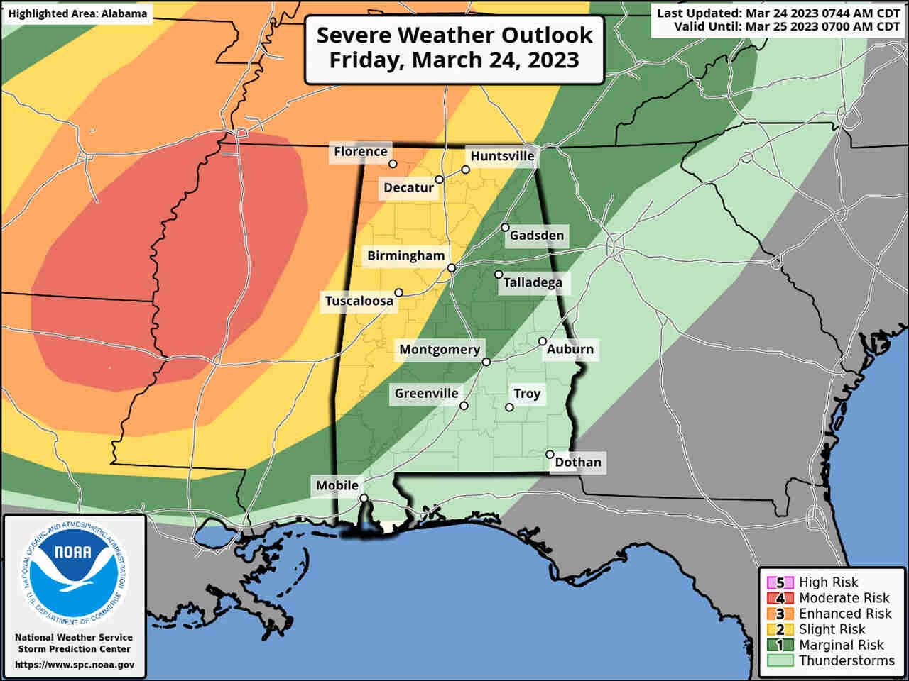
The Storm Prediction Center has a Level 3 out of 5 risk for severe weather in place at the northwest corner of Alabama tonight; a Level 3 – or “enhanced” – risk means that numerous severe storms will be possible. A large part of north, central and also west Alabama has a Level 2 risk tonight, meaning scattered severe storms are possible.
As of this (Friday) morning the Level 3 risk area has been trimmed back and does not include as much of Alabama as it did in earlier forecasts; however, that area across a a large part of northwest Alabama is still the location that has the higher probability of seeing severe storms. Forecasters are expecting a line of storms (and, it could be a broken line of storms) to approach Alabama from the west overnight, just ahead of a strong cold front; the storms could reach Alabama’s western border by 10:00pm, and then head eastward. The weather service is expecting them to lose some intensity as they move farther east, but severe weather will remain possible in east Alabama as well.
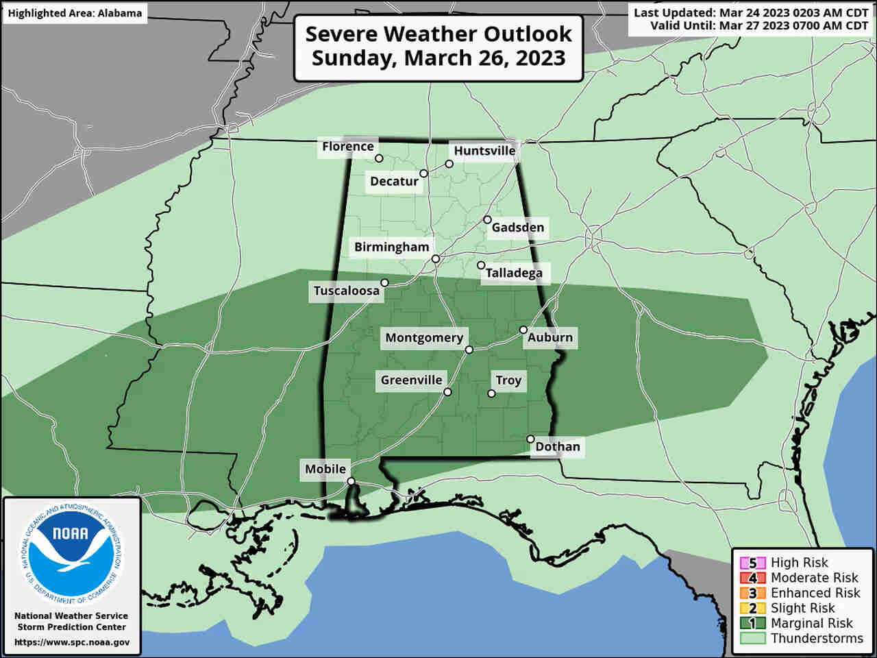
The threat for severe weather will NOT end with tonight’s storms – forecasters think most of south Alabama could again see a few strong to severe storms on Sunday as a warm front lifts northward over the state. Severe weather isn’t expected in northern Alabama on Sunday, but rain and a few storms will be possible there as well.


You must be logged in to post a comment.