
Get ready for another round of potentially severe storms in Alabama.
The National Weather Service said severe weather will be possible starting on Tuesday evening in west Alabama, and the threat will shift eastward overnight and into Wednesday morning.
The strongest storms could generate a tornado or two and bring damaging winds up to 60 mph and hail.
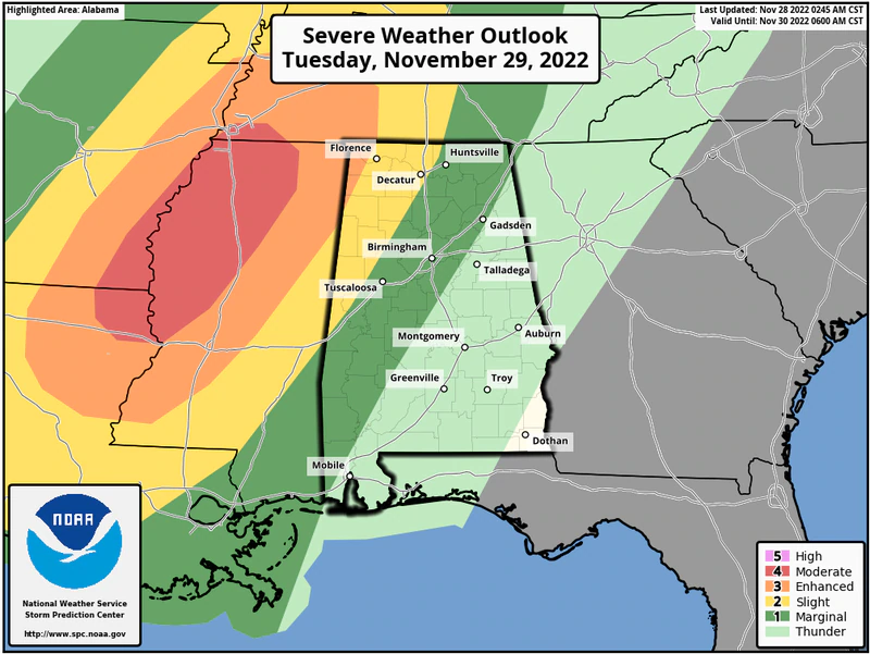
NOAA’s Storm Prediction Center has added a Level 3 out of 5 (or enhanced) risk for a sliver of northwest Alabama for Tuesday evening.
A Level 3 risk means that numerous severe storms will be possible.
The SPC also has a Level 2 out of 5 risk in place for other parts of north and west Alabama. A Level 2 risk means scattered severe storms will be possible.
Areas to the east and south of that have a Level 1 risk, which means that isolated severe storms will be possible.
The threat for storms will extend into Wednesday for those in south and east Alabama, and the SPC has a Level 1 severe weather risk in place for those areas.
Here is Wednesday’s severe weather outlook:
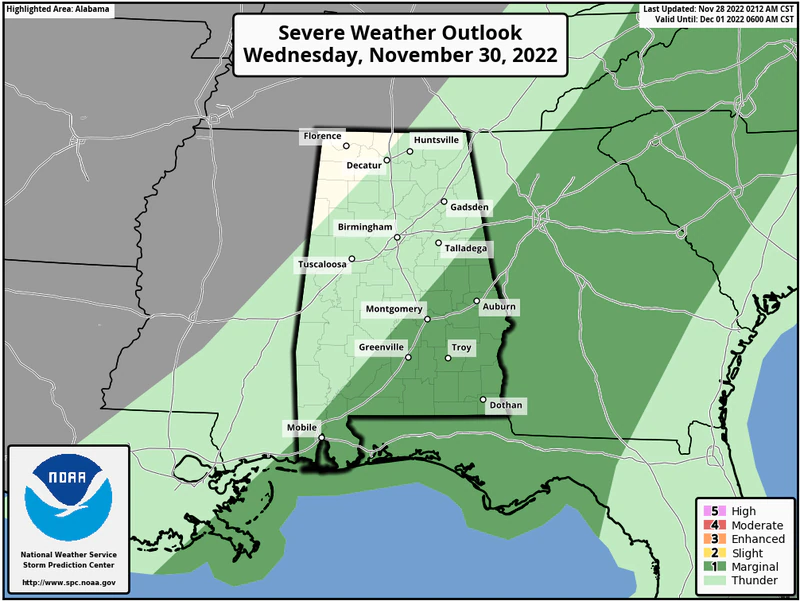
There will be a Level 1 out of 5 risk for severe weather in the areas in dark green on Wednesday.
The storms are expected to develop ahead of a cold front. The highest probabilities for storms will be in the western part of the state.
The weather service thinks the storms will lose some of their punch as they move eastward across Alabama, but severe weather will still be possible.
In addition to the potential for tornadoes and damaging winds there could be some heavy rain. The weather service said that up to 2.5 inches of rain will be possible in some areas through Wednesday morning.
NOAA’s Weather Prediction Center has a Level 2 out of 4 risk for flash flooding in place across a large part of the state from Tuesday into Wednesday.
Here is the excessive rainfall outlook for Tuesday:
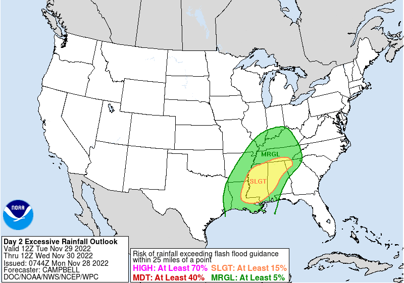
A large part of Alabama will have a Level 2 of 4 risk for flash flooding on Tuesday as a cold front moves through the state. Areas in green have a Level 1 flooding risk.


You must be logged in to post a comment.