
OVERVIEW:
A strong storm system is still expected to move into the Deep South on Tuesday. This will support the development of showers and thunderstorms across Central Alabama by Tuesday afternoon and evening. Strong to severe thunderstorms will be possible from then through Tuesday night.
CHANGES FROM PREVIOUS FORECAST:
Overall forecast thinking remains the same. Though we now have more specific information with appropriate threat graphics.
WHERE:
* All of Central Alabama
WHEN:
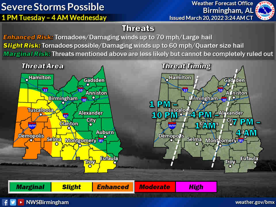
* 1 PM Tuesday afternoon through 4 AM Wednesday morning
THREATS:
* Tornadoes
* Damaging wind gusts
* Large Hail
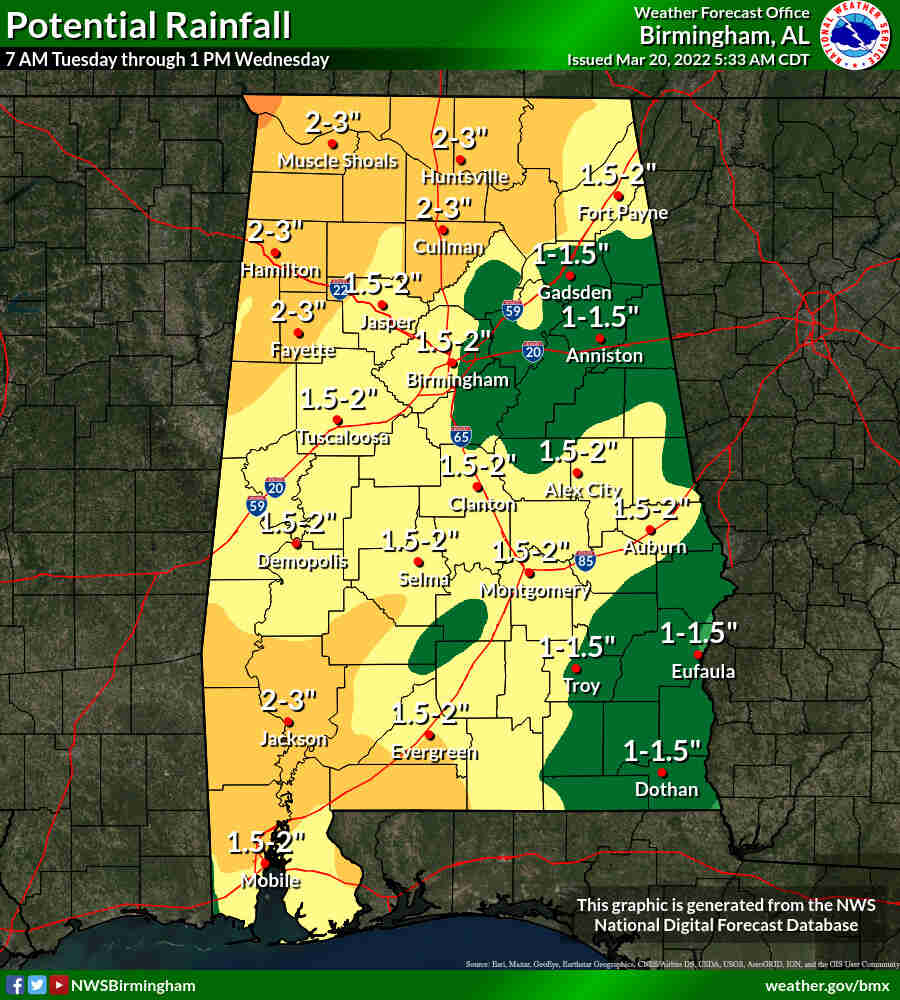
* Locally heavy rainfall -> isolated flooding
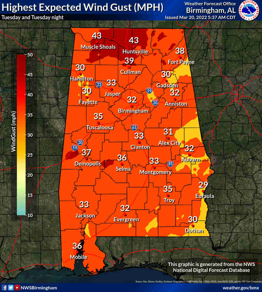
* Non-thunderstorm wind gusts of 30-40 mph
Another potential round of severe weather is shaping up for Tuesday afternoon into early Wednesday morning. West Alabama – roughly from Tuscaloosa southward – is expected to have the best chances of bad weather although it’ll be possible across the entire stateThe National Weather Service stressed in its forecast that a “potentially significant” severe weather event will be possible for southwest Alabama and weather safety and preparedness plans should be ready to go and everyone should have multiple ways to receive warning information Tuesday and Tuesday night.
The Storm Prediction Center has part of west Alabama in an enhanced risk for severe weather on Tuesday; an enhanced risk is Level 3 out of 5 and means that “numerous” severe storms will be possible. Most of the rest of south Alabama, and part of central Alabama, have a slight risk, which is Level 2 and means scattered severe storms will be possible. All of the rest of Alabama except the northeast corner will have a marginal or Level 1 risk on Tuesday as well. Storms will be possible as well in northeast Alabama.
The weather service noted that a rare Level 4 risk for storms sits just to the west of Alabama over southern Mississippi and parts of Louisiana. Forecasters added strong wind gusts will be possible even away from storms and could by themselves take out tree limbs and power lines. Heavy rain and the potential for flash flooding is also raising concerns. Parts of west Alabama could get 2 to 3 inches of rain by Wednesday morning. Flash flood watches could also be issued. Forecasters will also be watching closely in case any supercells develop ahead of that main complex of storms, and if those develop they would be watched for rotation.
The chances for severe storms will end after the main line of storms moves through.


You must be logged in to post a comment.