
BIRMINGHAM — The National Weather Service in Birmingham has expanded a Level 2 out of 5, or “Slight Risk,” for severe weather to include a larger portion of Central Alabama on Sunday as forecasters continue to monitor developing storms expected later in the day.
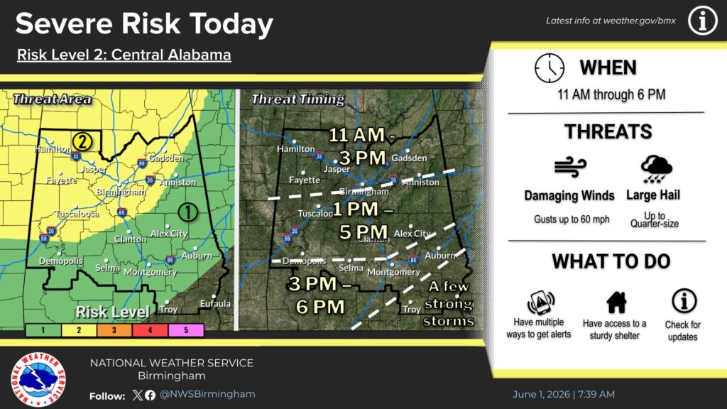
Forecasters say the primary threats will be isolated damaging wind gusts and hail, with the greatest risk occurring between approximately 11 a.m. and 6 p.m.
While widespread severe weather is not anticipated, the National Weather Service noted that the expanded risk area reflects a slightly higher potential for isolated strong storms capable of producing damaging winds.
Residents with outdoor plans are encouraged to remain weather aware throughout the day and monitor forecast updates, watches and warnings as conditions develop.
The National Weather Service will continue to provide updated forecasts and radar information as the storm system moves through Central Alabama.


You must be logged in to post a comment.