
From the National Weather Service in Birmingham:
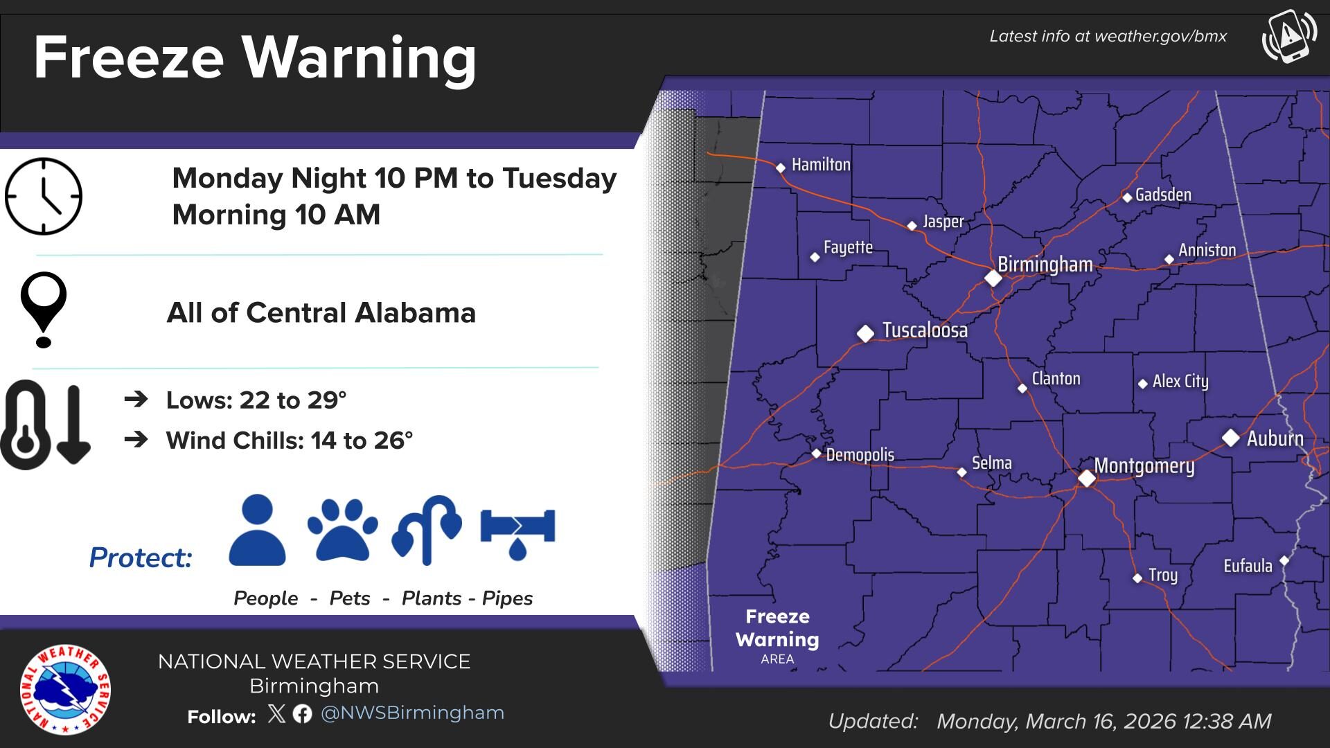
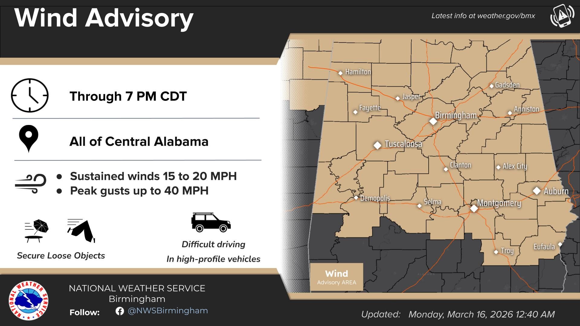
Freeze Warning & Wind Advisory
URGENT – WEATHER MESSAGE
National Weather Service Birmingham AL
1219 AM CDT Mon Mar 16 2026
…WIND ADVISORY NOW IN EFFECT UNTIL 7 PM CDT THIS EVENING…
…FREEZE WARNING REMAINS IN EFFECT FROM 10 PM THIS EVENING TO 10 AM CDT TUESDAY…
* WHAT…For the Wind Advisory, west winds 10 to 20 mph with gusts up to 40 mph. For the Freeze Warning, sub-freezing temperatures as low as 23 in the north and 28 in the south expected.
* WHERE…All of Central Alabama
* WHEN…For the Wind Advisory, until 7 PM CDT this evening. For the Freeze Warning, from 10 PM this evening to 10 AM CDT Tuesday.
* IMPACTS…Gusty winds will blow around unsecured objects. Trees could be blown down and a few power outages may result. Frost and freeze conditions could kill crops, other sensitive vegetation and possibly damage unprotected outdoor plumbing.
PRECAUTIONARY/PREPAREDNESS ACTIONS…
Winds this strong can make driving difficult, especially for high profile vehicles. Use extra caution.
Secure outdoor objects.
Take steps now to protect tender plants from the cold.
To prevent freezing and possible bursting of pipes they should be wrapped, drained, or allowed to drip slowly.
Those that have in ground sprinkler systems should drain them and cover above ground pipes to protect them from freezing.
Stay with WEIS 100.5 FM, 990 AM, and the WEIS Radio app for the latest weather updates.


You must be logged in to post a comment.