
Winter Storm Warning
URGENT – WINTER WEATHER MESSAGE
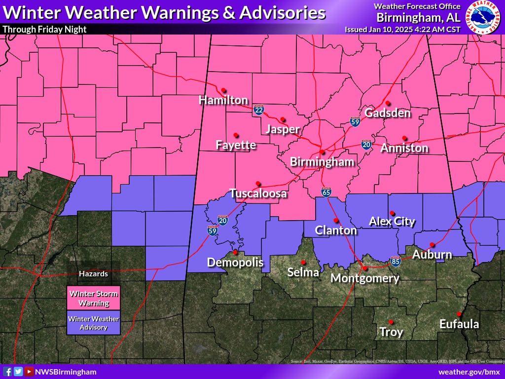
National Weather Service Birmingham AL
245 PM CST Fri Jan 10 2025
…WINTER STORM WARNING NOW IN EFFECT UNTIL MIDNIGHT CST TONIGHT…
* WHAT…Some localized temperatures remain near freezing in the warning area. Additional light ice accumulations around a light glaze will be possible through the evening.
* WHERE…Blount, Calhoun, Cherokee, Cleburne, Etowah, Fayette, Jefferson, Lamar, Marion, St. Clair, Walker, and Winston Counties.
* WHEN…Until midnight CST tonight.
* IMPACTS…Roads, and especially bridges and overpasses, will likely become slick and hazardous. Very slippery sidewalks, roads and bridges are possible. The hazardous conditions could impact the Friday evening commute.

PRECAUTIONARY/PREPAREDNESS ACTIONS…
If you must travel, keep an extra flashlight, food, and water in your vehicle in case of an emergency.
Persons should consider delaying all travel. Motorists should use extreme caution if travel is absolutely necessary.


You must be logged in to post a comment.