

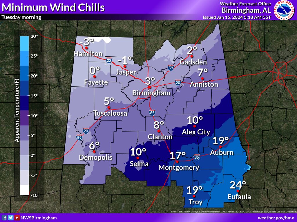
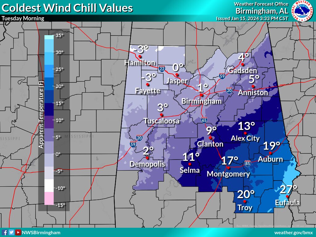
Wind Chill Advisory
URGENT - WINTER WEATHER MESSAGE
National Weather Service Birmingham AL
706 AM CST Tue Jan 16 2024

ALZ011-013>015-017-018-020-024-026-161630-
/O.CON.KBMX.WC.Y.0001.000000T0000Z-240116T1800Z/
/O.CON.KBMX.WC.Y.0002.240117T0200Z-240117T1400Z/
Marion-Fayette-Winston-Walker-Blount-Etowah-Cherokee-Jefferson-
St. Clair-
Including the cities of Hamilton, Fayette, Double Springs,
Jasper, Oneonta, Gadsden, Centre, Birmingham, Hoover, Pell City,
and Moody
706 AM CST Tue Jan 16 2024

...WIND CHILL ADVISORY REMAINS IN EFFECT UNTIL NOON CST TODAY...
...WIND CHILL ADVISORY REMAINS IN EFFECT FROM 8 PM THIS EVENING
TO 8 AM CST WEDNESDAY...

* WHAT...For the first Wind Chill Advisory for this morning,
  very cold wind chills. Wind chills as low as 5 below zero. For
  the second Wind Chill Advisory tonight into Wednesday, very
  cold wind chills expected. Wind chills as low as 5 below zero.

* WHERE...Marion, Fayette, Winston and Walker Counties.

* WHEN...For the first Wind Chill Advisory, until noon CST
  today. For the second Wind Chill Advisory, from 8 PM this
  evening to 8 AM CST Wednesday.

* IMPACTS...The cold wind chills could result in hypothermia if
  precautions are not taken.

PRECAUTIONARY/PREPAREDNESS ACTIONS...

Use caution while traveling outside. Wear appropriate clothing, a
hat, and gloves.


You must be logged in to post a comment.