
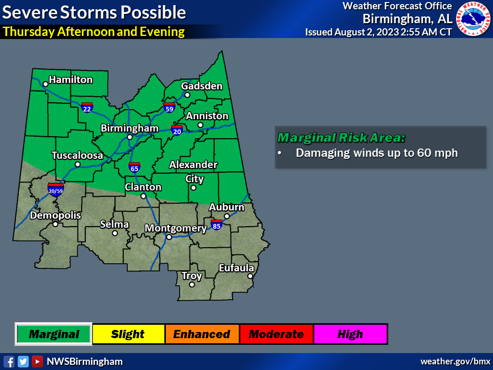
An active weather pattern will begin to set back up by the end of the week, beginning on Thursday. Clusters of showers and storms are expected to develop to the north of Central Alabama and move southward Thursday afternoon through Thursday evening. A few of these storms could be severe, with locally heavy rainfall.
Where: The northern half of Central Alabama
When: Thursday Afternoon and Evening
Threats: Damaging winds up to 60mph
- Localized flooding due to heavy rainfall
Additional upcoming threats: As the pattern remains very active through the end of the week, we could see additional clusters of showers and storms during the day on Friday. If this occurs, similar hazards can be expected with gusty winds and heavy rainfall that could lead to flooding. Although nothing official is being advertised due to uncertainty as to where the storms will develop and track, we wanted to give everyone a heads up of the potential. Stay tuned to WEIS Radio, 100.5 FM, 990 AM, online at www.weisradio.com, on your WEIS Radio App.


You must be logged in to post a comment.