
 Wind Chill Warning
URGENT – WINTER WEATHER MESSAGE
National Weather Service Birmingham AL
246 AM CST Fri Dec 23 2022
ALZ011>015-017-018-020-024-026-231830-
/O.CON.KBMX.WC.W.0001.000000T0000Z-221223T1800Z/
/O.CON.KBMX.WC.Y.0001.221223T1800Z-221224T1800Z/
Marion-Lamar-Fayette-Winston-Walker-Blount-Etowah-Cherokee-
Jefferson-St. Clair-
Including the cities of Hamilton, Sulligent, Vernon, Fayette,
Double Springs, Jasper, Oneonta, Gadsden, Centre, Birmingham,
Hoover, Pell City, and Moody
246 AM CST Fri Dec 23 2022
…WIND CHILL WARNING REMAINS IN EFFECT UNTIL NOON CST TODAY…
…WIND CHILL ADVISORY REMAINS IN EFFECT FROM NOON TODAY TO NOON
CST SATURDAY…
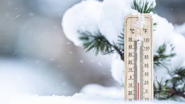
* WHAT…For the Wind Chill Warning, dangerously low wind chills
expected. Wind chills as low as 15 below zero. For the Wind
Chill Advisory, very low wind chills expected. Wind chills as
low as 5 below zero. Northwest winds at 15 to 25 mph with gusts
up to 40 mph are possible.
* WHERE…Northern third of central Alabama.
* WHEN…For the Wind Chill Warning, through noon CST today. For
the Wind Chill Advisory, from noon Friday to noon CST Saturday.
* IMPACTS…The dangerously low wind chills could result in
hypothermia or frostbite if precautions are not taken. Gusty
winds could blow around unsecured objects. Tree limbs could be
blown down and a few power outages may result.
PRECAUTIONARY/PREPAREDNESS ACTIONS…
Avoid outside activities if possible. When outside, make sure you
wear appropriate clothing, a hat, and gloves.
Use caution while traveling outside. Wear appropriate clothing, a
hat, and gloves.
Hard Freeze Warning
URGENT – WEATHER MESSAGE
National Weather Service Birmingham AL
241 AM CST Fri Dec 23 2022
ALZ011>015-017>050-232100-
/O.CON.KBMX.HZ.W.0001.000000T0000Z-221225T1500Z/
Marion-Lamar-Fayette-Winston-Walker-Blount-Etowah-Calhoun-
Cherokee-Cleburne-Pickens-Tuscaloosa-Jefferson-Shelby-St. Clair-
Talladega-Clay-Randolph-Sumter-Greene-Hale-Perry-Bibb-Chilton-
Coosa-Tallapoosa-Chambers-Marengo-Dallas-Autauga-Lowndes-Elmore-
Montgomery-Macon-Bullock-Lee-Russell-Pike-Barbour-
Including the cities of Hamilton, Sulligent, Vernon, Fayette,
Double Springs, Jasper, Oneonta, Gadsden, Anniston, Centre,
Heflin, Carrollton, Tuscaloosa, Birmingham, Hoover, Columbiana,
Pelham, Alabaster, Pell City, Moody, Talladega, Sylacauga,
Ashland, Roanoke, Livingston, Eutaw, Greensboro, Moundville,
Marion, Centreville, Clanton, Rockford, Alexander City,
Dadeville, Valley, Lanett, Lafayette, Demopolis, Linden, Selma,
Prattville, Fort Deposit, Hayneville, Wetumpka, Tallassee,
Montgomery, Tuskegee, Union Springs, Auburn, Opelika,
Phenix City, Troy, and Eufaula
241 AM CST Fri Dec 23 2022
…HARD FREEZE WARNING REMAINS IN EFFECT UNTIL 9 AM CST SUNDAY…
* WHAT…Sub-freezing temperatures as low as 5 to 12 will be
possible in northern portions of Central Alabama. Temperatures
as low as 10 to 15 will be possible in southern portions of
Central Alabama. Temperatures remain below freezing from late
Thursday night until at least midday Sunday. Far northern
portions of Central Alabama may remain below freezing until
Monday.
* WHERE…All of central Alabama.
* WHEN…From midnight tonight to 9 AM CST Sunday.
* IMPACTS…A prolonged period of subfreezing temperatures may
cause pipes to burst. Bitterly cold temperatures and wind
chills will result in hypothermia or frostbite and become life-
threatening to those with prolonged exposure or without
access to adequate warmth.
PRECAUTIONARY/PREPAREDNESS ACTIONS…
Take steps now to protect tender plants from the cold. To prevent
freezing and possible bursting of outdoor water pipes they should
be wrapped, drained, or allowed to drip slowly. Those that have
in-ground sprinkler systems should drain them and cover above-
ground pipes to protect them from freezing.


You must be logged in to post a comment.