
More above-average temperatures and heat advisories will be in effect for today with temperatures expected to reach the upper 90’s across the state – and those readings, combined with high humidity will cause it to feel even hotter outside.
The typical high temperature in Alabama for this time of year is upper 80’s to around 90 degrees, according to data from the National Weather Service.
The heat index or “feels like” temperatures are expected to climb even higher, 105 to 110 degrees; there won’t be much relief at night either as lows only fall into the 70’s.
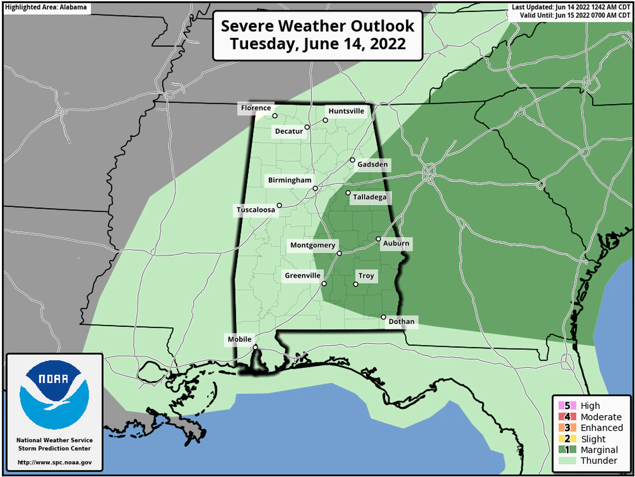
Isolated storms will be possible for today (Tuesday), and the strongest of those could bring damaging winds, heavy rainfall and lightning, BUT they could also knock down temperatures a few degrees temporarily.
NORTH ALABAMA
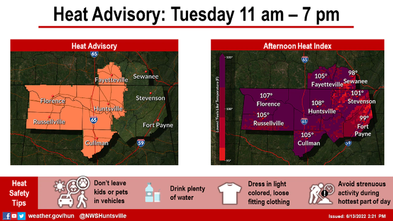
A Heat Advisory will be in effect from 11:00am – 7:00pm – both today, and tomorrow (Tuesday and Wednesday) for much of north Alabama; that according to the National Weather Service in Huntsville. And the Heat Index could reach as high as 107 degrees both this afternoon and on Wednesday.

CENTRAL ALABAMA
A Heat Advisory will be in effect for all of central Alabama – both today and until 7:00 Wednesday evening, according to the National Weather Service in Birmingham – and that includes Cherokee County. The Weather Service said the heat index could range from 104 to 107 degrees this afternoon.


You must be logged in to post a comment.