
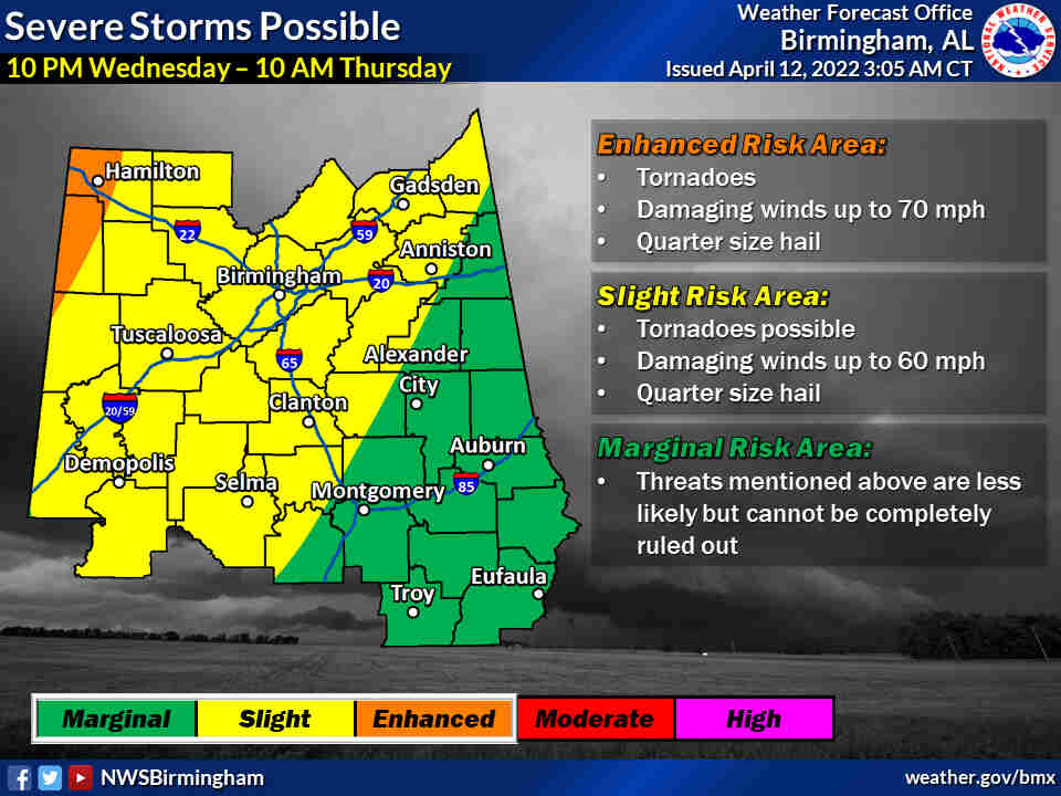
The National Weather Service says that a strong cold front will be moving in Wednesday night through Thursday morning bringing with it the potential for strong to severe storms.
The mains risks will be for tornadoes, damaging winds up to 70 miles per hour and localized flooding.
The weather service has placed Cherokee, Calhoun, Cleburne and Etowah Counties under the Slight Risk category from 1am to 7am Thursday.
Make sure to have multiple ways to receive your weather alerts. We have provided the QR codes below.


You must be logged in to post a comment.