
A storm system will move through the region Wednesday bringing the potential for strong and severe storms, strong/gusty winds well ahead of any thunderstorm activity, and localized flooding.
WHERE:
* All of Central Alabama
WHEN:
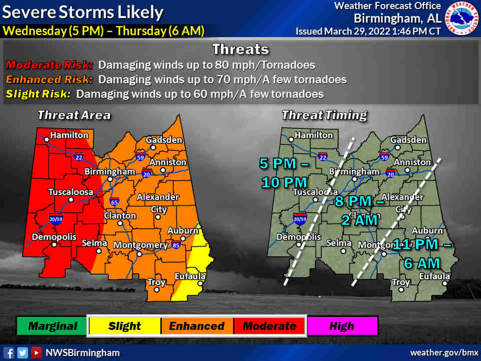
* Severe Storms and Flooding: 5pm Wednesday – 6am Thursday
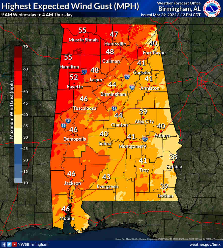
* Non-Thunderstorm Wind: 9am Wednesday – 4am Thursday
THREATS:
* Damaging thunderstorm winds up to 80 mph
* Tornadoes
* Non-thunderstorm wind gusts up to 50 mph with locally higher gusts, capable of downing some trees well ahead of any thunderstorm activity
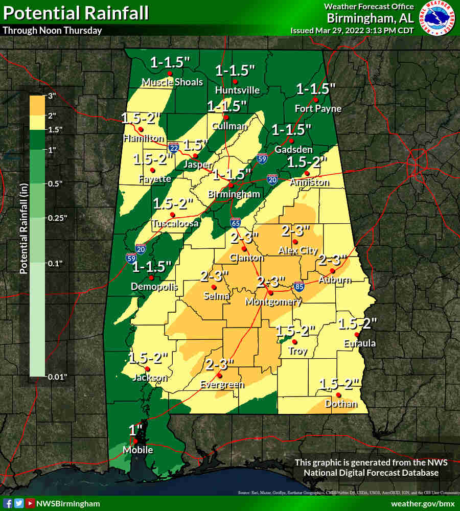
* Localized flooding, especially in urban and/or poor drainage areas.
NOW is the time to prepare! Make sure to have multiple ways to receive weather alerts! Text WEATHER1 to 256-646-5300 to receive FREE weather alerts from WEIS. You can also sign up for FREE code red alerts and download the free app from our partners from the Cherokee County Emergency Management Agency.
In the event that a Tornado Watch is issued in Cherokee County, the EMA office will coordinate the opening of storm shelters across the county throughout the duration of the watch.
Those locations will include:
- The Centre Elementary School Storm Shelter
- The New Bethel Storm Shelter
- Sand Rock Storm Shelter
- The Cedar Bluff Community Center/Fire Department (SAFER PLACE)
- The Leesburg FEMA Building Storm Shelter


You must be logged in to post a comment.