
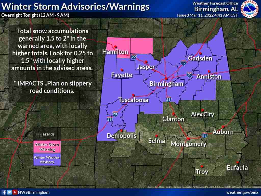
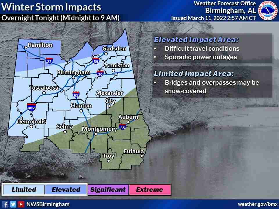
Rain will transition to snow across the northwest counties initially toward midnight, then the cold air will continue moving southeast, resulting in rain changing to snow across portions of central Alabama.
The greatest impacts are expected across the northern and northwest areas.
Much of the WEIS Radio listening area is under a Winter Weather Advisory.
Total snowfall from just south of I-20 to a Hamilton – Cullman – Fort Payne line will range from 0.25 – 1.5 inches. North of a Hamilton – Cullman – Fort Payne line, 2-4 inches are forecast. In both locations, locally higher amounts may occur.
Driving conditions could likely be hazardous in many locations as temperatures will drop to the lower 20s in the north and around 30 as far south as Hwy 80/I-85 by sunrise Saturday. There may be slick spots on bridges and overpasses south of I-20 due to the freezing of water.
Please make preparations now for very cold conditions.
Some sensitive plants may have started growing recently, pets will need to be in adequate shelter and stay safe keeping warm this weekend.


You must be logged in to post a comment.