
This Hazardous Weather Outlook is for the counties served by the National Weather Service office in Birmingham.
Outlook through Tonight.
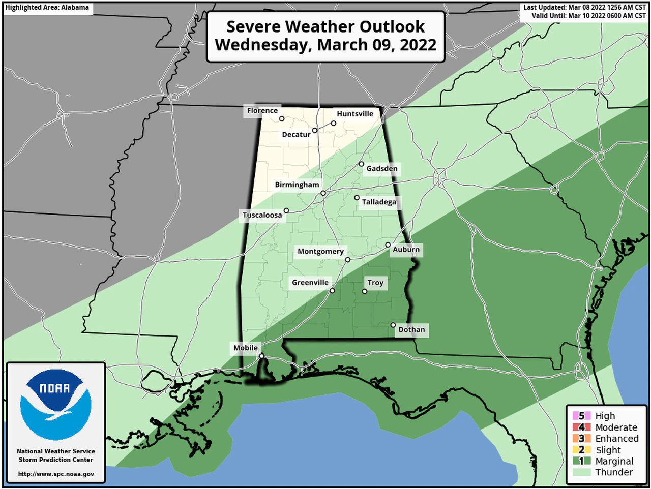
Severe thunderstorms are possible late tonight after 4 AM across southeast portions of Central Alabama along and south of Interstate 85. Threats include damaging winds up to 60 mph and a brief tornado.
Wednesday through Monday.
Severe thunderstorms will still be possible through 9:00am Wednesday across southeast portions of Central Alabama along and south of Interstate 85. The threats include damaging winds up to 60 mph and a brief tornado Strong to severe thunderstorms are possible again Friday afternoon and evening, mainly across southern portions of Central Alabama. Threats include damaging winds up to 60 mph and quarter size hail. Rain may mix with or change over to snow or sleet late Friday night.
Light accumulations on grassy or elevated surfaces are possible mainly north of Interstate 20.
Breezy conditions are expected Friday night and Saturday. Northwest winds of 15 to 25 mph with gusts up to 35 mph will be possible across all of Central Alabama. Temps are forecast to drop below freezing across portions of Central Alabama Friday night and all of Central Alabama on Saturday night. Residents should take action to protect sensitive vegetation.


You must be logged in to post a comment.