From the Birmingham National Weather Service: Deteriorating weather conditions can be expected beginning today, with a potential for isolated severe storms, along with flooding. This will all occur before Helene even enters into the picture starting tomorrow, with impacts now expected to be more significant, as the track has shifted a bit further to the west.
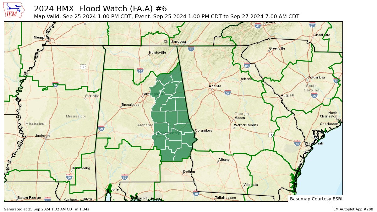
A Flood Watch is now in effect for the eastern third of Central Alabama. In addition, the Marginal Risk of severe storms has expanded to include more counties across the east and northeast.
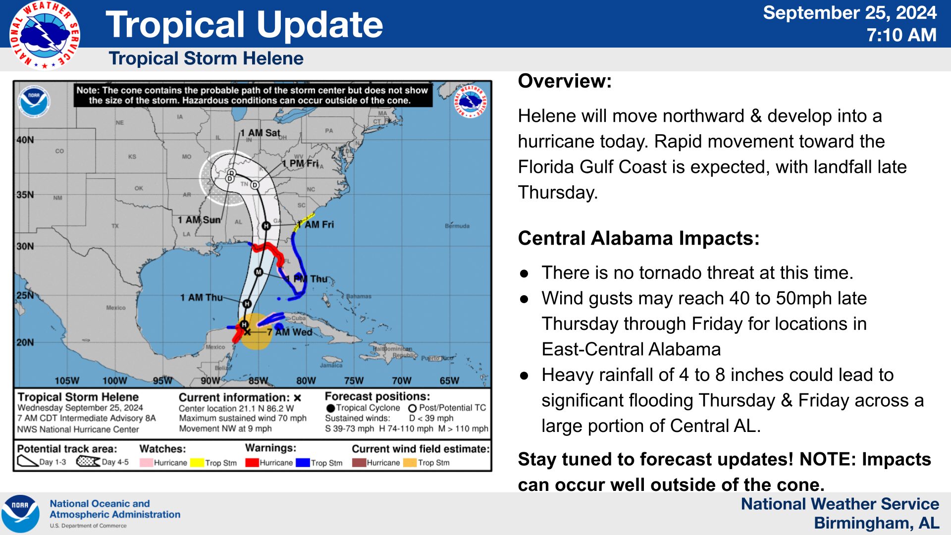
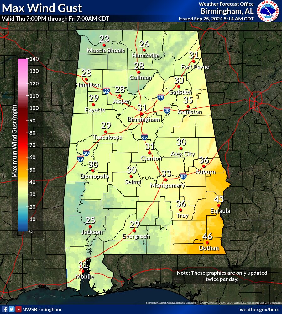
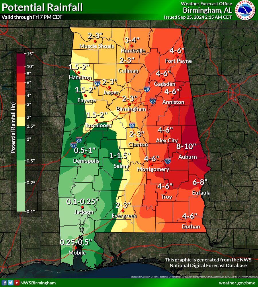
Helene continues to strengthen, with a forecast track slightly to the west. More significant impacts could be felt due to this change, with now higher forecast wind gusts and higher rainfall totals, especially across eastern Alabama.
Severe Storm Risk Today:
Where: Eastern and southeastern counties in Central Alabama
When: 10am to 4pm
Threats: Damaging winds up to 60mph
A brief tornado will be possible
Flood Risk Today:
Where: Eastern third of Central Alabama
Threats: Showers and storms with heavy rainfall that develop today could move over similar areas and cause flooding. This rainfall today could lead to more extensive flood potential as Helene moves into the area Thursday and Friday.
Helene Threats for Thursday and Friday:
Tornado: Tornado Risk still appears minimal at this time.
Wind: Wind gusts of 40 to 50 mph are now forecast for eastern Alabama, with highest gusts across the far southeast counties along and south of the I-85 corridor.
Flooding: Rainfall amounts continue to increase, with the potential of 4 to 8 inches of rain with isolated pockets of 10 inches possible. Depending on how much rain falls during the day today, that could lead to a heightened flood threat when Helene arrives.
Heaviest rainfall is forecast along and east of I-65, with highest totals along and east of a line from Cherokee to Tallapoosa, to Montgomery Counties.


