

Frost Advisory
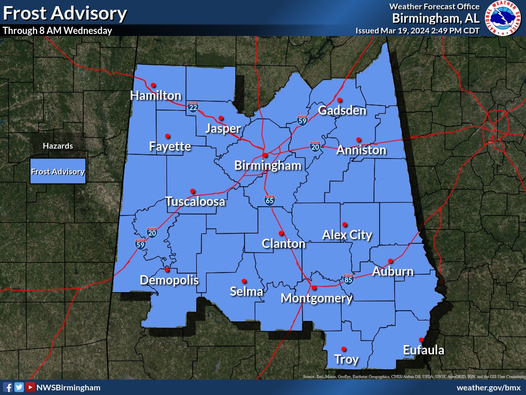
URGENT - WEATHER MESSAGE
National Weather Service Birmingham AL
1233 PM CDT Tue Mar 19 2024

ALZ011>015-017>050-200300-
/O.NEW.KBMX.FR.Y.0003.240320T0800Z-240320T1300Z/
Marion-Lamar-Fayette-Winston-Walker-Blount-Etowah-Calhoun-
Cherokee-Cleburne-Pickens-Tuscaloosa-Jefferson-Shelby-St. Clair-
Talladega-Clay-Randolph-Sumter-Greene-Hale-Perry-Bibb-Chilton-
Coosa-Tallapoosa-Chambers-Marengo-Dallas-Autauga-Lowndes-Elmore-
Montgomery-Macon-Bullock-Lee-Russell-Pike-Barbour-
Including the cities of Auburn, Oneonta, Greensboro, Jasper,
Hayneville, Selma, Dadeville, Union Springs, Talladega, Lanett,
Fort Deposit, Pelham, Wetumpka, Vernon, Alabaster, Tallassee,
Hamilton, Centre, Birmingham, Ashland, Heflin, Marion, Eufaula,
Anniston, Gadsden, Sylacauga, Clanton, Carrollton, Tuskegee,
Hoover, Fayette, Opelika, Lafayette, Double Springs, Moundville,
Phenix City, Centreville, Eutaw, Pell City, Roanoke, Rockford,
Alexander City, Valley, Linden, Montgomery, Moody, Livingston,
Columbiana, Prattville, Troy, Sulligent, Demopolis, and
Tuscaloosa
1233 PM CDT Tue Mar 19 2024

...FROST ADVISORY IN EFFECT FROM 3 AM TO 8 AM CDT WEDNESDAY...

* WHAT...Temperatures as low as 34 will result in frost formation.

* WHERE...All of central Alabama.

* WHEN...From 3 AM to 8 AM CDT Wednesday.

* IMPACTS...Frost could harm sensitive outdoor vegetation. Sensitive
  outdoor plants may be killed if left uncovered.

PRECAUTIONARY/PREPAREDNESS ACTIONS...

Take steps now to protect tender plants from the cold.


You must be logged in to post a comment.