
Flood Watch
National Weather Service Huntsville AL
821 AM CDT Fri May 22 2026
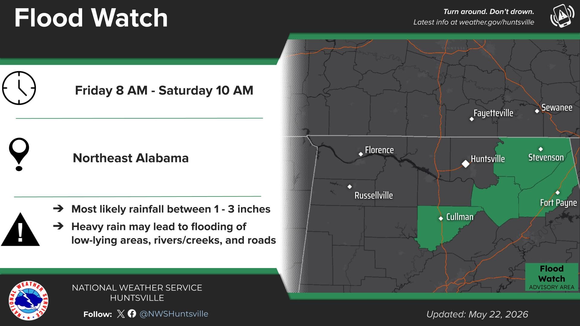
.Multiple rounds of rain and thunderstorms are anticipated across the Flash Flood Watch area through Saturday morning. With soils becoming increasingly saturated, additional rainfall will efficiently be converted to runoff, enhancing the risk for flash flooding.
Marshall-Jackson-DeKalb-Cullman-
Including the cities of Guntersville, Arab, Fort Payne, Rainsville, Scottsboro, Boaz, Cullman, and Albertville
…FLASH FLOOD WATCH IN EFFECT THROUGH SATURDAY MORNING…
* WHAT…Flash flooding caused by excessive rainfall is possible.
* WHERE…Portions of north central and northeast Alabama, including the following counties, in north central Alabama, Cullman. In northeast Alabama, DeKalb, Jackson and Marshall.
* WHEN…Through Saturday morning.
* IMPACTS…Excessive runoff may result in flooding of rivers, creeks, streams, and other low-lying and flood-prone locations.
* ADDITIONAL DETAILS…
– The combination of saturated soils and several additional rounds of heavy rainfall will result in an increasing risk for flash flooding.
– http://www.weather.gov/safety/flood
PRECAUTIONARY/PREPAREDNESS ACTIONS…
You should monitor later forecasts and be prepared to take action should Flash Flood Warnings be issued.
Stay with WEIS 100.5 FM, 990 AM, and the WEIS Radio app for the latest weather updates!


You must be logged in to post a comment.