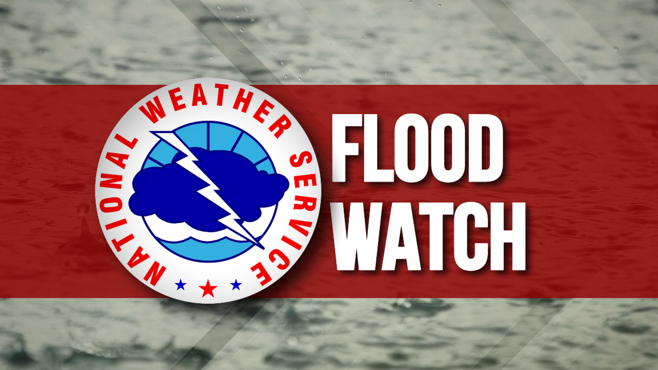
Flood Watch
National Weather Service Birmingham AL
309 AM CST Wed Dec 14 2022

ALZ011>015-017>020-022>026-030>032-034-142200-
/O.CON.KBMX.FA.A.0008.000000T0000Z-221215T0600Z/
/00000.0.ER.000000T0000Z.000000T0000Z.000000T0000Z.OO/
Marion-Lamar-Fayette-Winston-Walker-Blount-Etowah-Calhoun-Cherokee-
Pickens-Tuscaloosa-Jefferson-Shelby-St. Clair-Sumter-Greene-Hale-
Bibb-
Including the cities of Sulligent, Hoover, Pelham, Double Springs,
Fayette, Pell City, Eutaw, Jasper, Oneonta, Alabaster, Centre,
Moody, Carrollton, Columbiana, Tuscaloosa, Vernon, Anniston,
Greensboro, Gadsden, Hamilton, Birmingham, Centreville, Livingston,
and Moundville
309 AM CST Wed Dec 14 2022

...FLOOD WATCH REMAINS IN EFFECT THROUGH THIS EVENING...

* WHAT...Flash flooding caused by excessive rainfall is possible.
  Rainfall totals of 2 to 4 inches are expected with locally higher
  amounts possible.

* WHERE...A portion of Central Alabama, including the following
  counties, Bibb, Blount, Calhoun, Cherokee, Etowah, Fayette,
  Greene, Hale, Jefferson, Lamar, Marion, Pickens, Shelby, St.
  Clair, Sumter, Tuscaloosa, Walker and Winston.

* WHEN...Through this evening.

* IMPACTS...Excessive runoff may result in flooding of rivers,
  creeks, streams, and other low-lying and flood-prone locations.
  Creeks and streams may rise out of their banks. Flooding may occur
  in poor drainage and urban areas.

* ADDITIONAL DETAILS...
  - http://www.weather.gov/safety/flood

PRECAUTIONARY/PREPAREDNESS ACTIONS...

You should monitor later forecasts and be prepared to take action
should Flash Flood Warnings be issued.