


GADSDEN — Etowah County residents could face heavy rain, gusty winds and localized flash flooding Friday night into Saturday as Tropical Storm Isaias approaches the Gulf Coast.
In an October 7 weather notification, the Etowah County Emergency Management Agency outlined potential local impacts. The agency listed Friday night through Saturday night as the overall period of concern.
However, the release places the initial arrival of local impacts Friday night, with those conditions continuing through Saturday morning. That means residents should prepare for an overnight weather threat as the weekend begins.
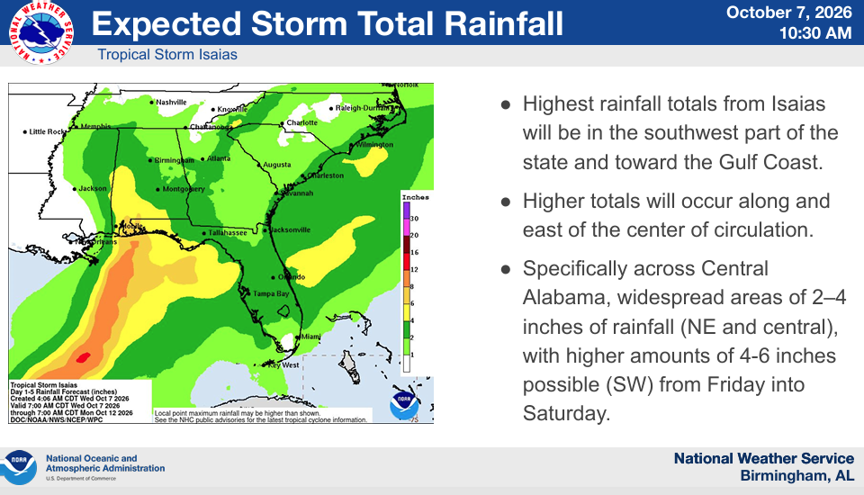
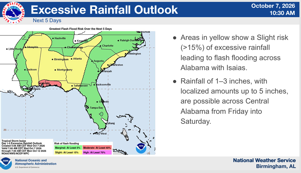
EMA’s local forecast calls for 2 to 4 inches of rain, with isolated totals reaching 6 inches. Heavy downpours could lead to localized flash flooding, particularly where rain repeatedly falls over the same areas.
In addition, sustained winds could reach 20 mph, with higher gusts possible. Although those winds are below tropical storm strength, the agency cautioned that saturated ground and wind gusts could bring down trees and power lines.
As a result, residents should consider the possibility of power outages along with flooding. The release also identifies a low tornado risk at this time, a forecast that could change as the storm develops.
Isaias was a tropical storm when EMA issued the notification. The release forecast strengthening to a hurricane Thursday morning and landfall along the Alabama coast Friday.
However, the National Weather Service in Birmingham says uncertainty remains over the storm’s exact track, timing and intensity. Its Wednesday update also identifies heavy rain and gusty winds as the main central Alabama impacts Friday into Saturday.
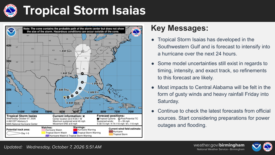
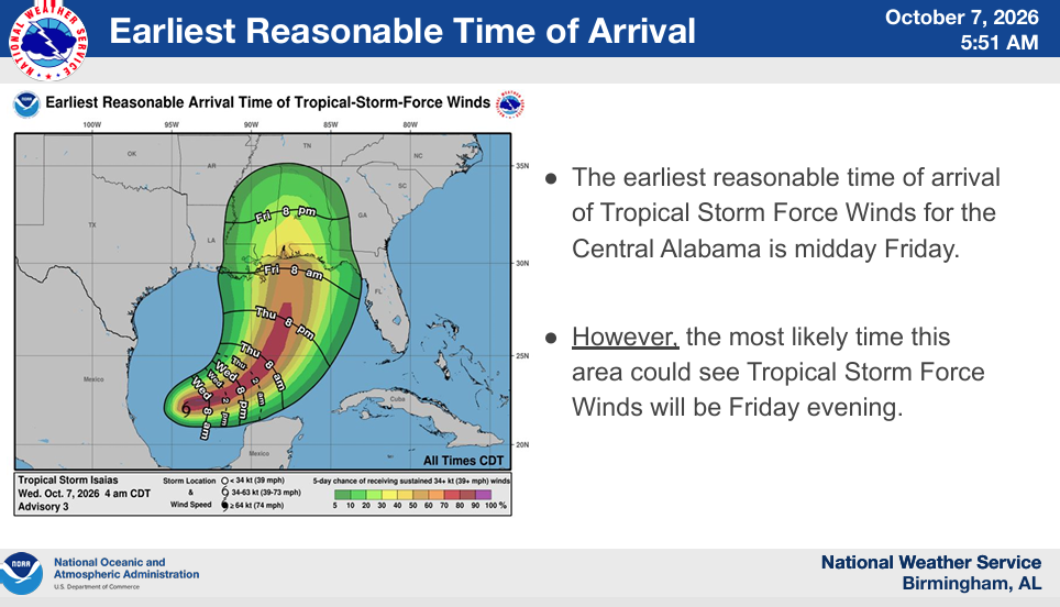
The maps accompanying EMA’s release show regional rainfall expectations, the storm’s projected track and possible arrival times for tropical storm force winds. However, those regional wind maps do not mean every Etowah County location will experience tropical storm force winds.
For local planning, EMA’s written notification lists sustained winds up to 20 mph. Residents should follow updated forecasts rather than treating any single map as a final prediction for their neighborhood.
Meanwhile, the weather service recommends preparing for outages with food, water, medications, flashlights and batteries. Charge phones and other essential devices before conditions deteriorate, and have supplies that meet your household’s needs.
Drivers should never cross flooded roads. In addition, residents should avoid trees tangled in power lines and notify their utility or emergency services.
Anyone using a generator should keep it at least 20 feet from windows and doors to prevent carbon monoxide poisoning. The weather service includes that precaution in its Isaias preparedness guidance.
Etowah County EMA will continue monitoring the storm and sharing updates as forecasts develop. For the latest local weather information, visit weather.gov/bmx.
Questions about the agency’s notification may go to ema@etowahcounty.org.



You must be logged in to post a comment.