
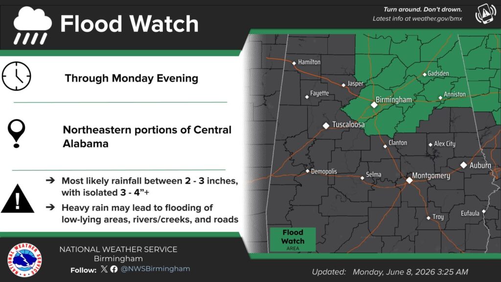
The National Weather Service in Birmingham has issued a Flood Watch for much of the WEIS listening area due to the potential for excessive rainfall that could lead to flooding.
The Flood Watch is in effect from 7 a.m. Monday morning through Monday evening and includes the counties of Blount, Calhoun, Cherokee, Cleburne, Etowah, Jefferson, Shelby, St. Clair, and Talladega.
Forecasters say flooding caused by heavy rainfall is possible, with excessive runoff potentially leading to rising water levels in rivers, creeks, streams, and other low-lying or flood-prone areas. Urban locations and areas with poor drainage may also experience flooding issues.
Officials emphasize that a Flood Watch means conditions are favorable for flooding to develop, but flooding is not yet occurring. Residents are urged to stay alert and monitor the latest forecasts for possible Flood Warnings.
Those in flood-prone areas are encouraged to have a plan in place and be prepared to take action if conditions worsen.
The National Weather Service also reminds motorists never to drive through flooded roadways, as even a small amount of moving water can be dangerous and difficult to see.
Additional weather safety information is available at weather.gov.


You must be logged in to post a comment.