
Severe Weather Risk Issued for Portions of Central Alabama Tuesday Into Wednesday
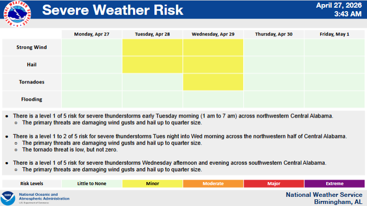
CENTRAL ALABAMA — Forecasters are monitoring multiple rounds of potential severe weather impacting portions of Central Alabama beginning early Tuesday morning and continuing through Wednesday evening.
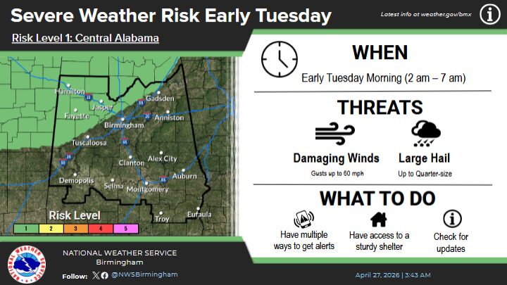
According to the latest outlook, a Level 1 of 5 risk for severe thunderstorms is in place for northwestern Central Alabama during the early morning hours Tuesday, from approximately 1 a.m. to 7 a.m. The primary threats during this period include damaging wind gusts and hail up to quarter size.
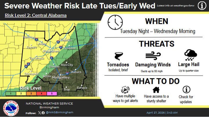
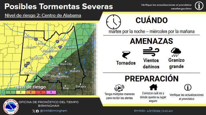
Additional rounds of storms are expected Tuesday night into Wednesday morning across the northwestern half of Central Alabama, where a Level 1 to Level 2 risk has been issued. Forecasters again cite damaging winds and hail as the main concerns, with a low, but not zero, risk of tornado activity.
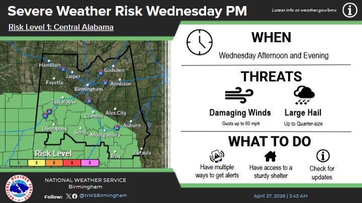
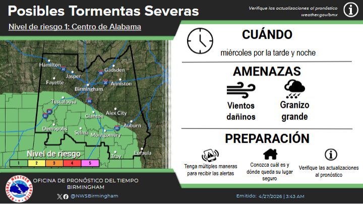
A separate Level 1 risk is also forecast for Wednesday afternoon and evening across southwestern Central Alabama. The primary hazards in this timeframe remain damaging wind gusts and quarter-size hail.
Officials encourage residents across the affected areas to stay weather-aware, monitor forecasts closely, and have multiple ways to receive warnings as conditions develop.


You must be logged in to post a comment.