
NWS: Severe Weather Risk Continues for Parts of Central Alabama
Birmingham- The National Weather Service in Birmingham is monitoring the potential for severe weather across Central Alabama, with forecasters highlighting two separate periods of concern in the coming days.
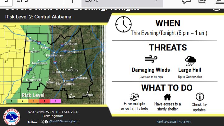
A Level 2 out of 5 risk for severe thunderstorms is in place Friday afternoon through Saturday morning, primarily affecting western portions of Central Alabama. Meteorologists say this level indicates the potential for scattered severe storms capable of producing damaging winds and other hazardous conditions.
In addition, forecasters note another round of possible severe thunderstorms Monday into Monday night. While details regarding timing and specific hazards remain uncertain, officials say additional updates will be provided as the event approaches.
The previously issued Level 2 risk for Central Alabama has since been removed this morning. However, the National Weather Service says a Level 1 risk may be introduced as early as tomorrow as confidence in the forecast increases.
Residents are encouraged to stay weather-aware and monitor updated forecasts from the National Weather Service in Birmingham as conditions evolve.


You must be logged in to post a comment.