
OVERVIEW:
A severe weather threat is expected to develop across Central Alabama Sunday night into Monday morning. This system will affect much of Central Alabama, including Cherokee County, which is currently in a Slight Risk area (level 2 out of 5) for severe weather.
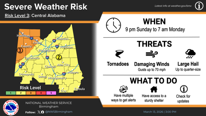
WHEN:
Storm activity could begin affecting parts of Alabama as early as 9:00 PM Sunday and continue through around 7:00 AM Monday.
THREATS:
• Damaging winds up to 70 miles per hour
• Tornadoes
• Large hail up to quarter size
• Heavy rainfall that could lead to localized flash flooding
Preparedness Reminder:
Because this system is expected to move through overnight, residents should make sure they have multiple ways to receive weather warnings while they are asleep and be prepared to take action quickly if warnings are issued.