
A Winter Weather Advisory, Wind Advisory, and Extreme Cold Warning are now in effect across much of East Alabama.
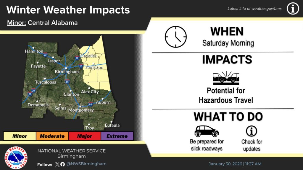
The National Weather Service in Birmingham says snow will move in around midnight tonight, with totals between a half inch and one inch possible across Cherokee, Etowah, Calhoun, Clay, Cleburne, and Randolph Counties. Roads could become slick by early Saturday morning.
At the same time, a Wind Advisory runs from 2 a.m. until 9 p.m. Saturday, with northwest winds 15 to 25 miles per hour and gusts up to 40.
Then conditions turn dangerously cold. An Extreme Cold Warning begins at noon Saturday and lasts until noon Sunday. Wind chills could drop below 5 degrees, with some areas feeling as cold as 4 above zero.
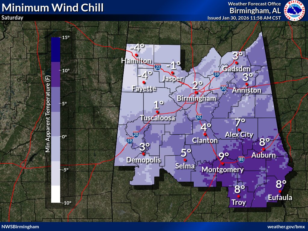
Officials warn gusty winds could down trees and cause isolated power outages. The prolonged freeze may also burst pipes, and frostbite or hypothermia can happen quickly if skin is exposed.
Residents should secure outdoor items, dress in layers, bring pets indoors, and check on elderly neighbors. Never use generators or grills inside. If you must travel, slow down and use extra caution.
WEIS will keep you up to date on the radio and online.


You must be logged in to post a comment.