
Hazardous Weather Risk Expected Across Central Alabama Wednesday and Thursday
The National Weather Service in Birmingham is warning residents across Central Alabama to be prepared for the potential of strong storms midweek as a frontal boundary pushes through the region.
Forecasters say storms could develop late Wednesday and continue into Thursday, bringing the main threat of damaging winds up to 60 miles per hour.
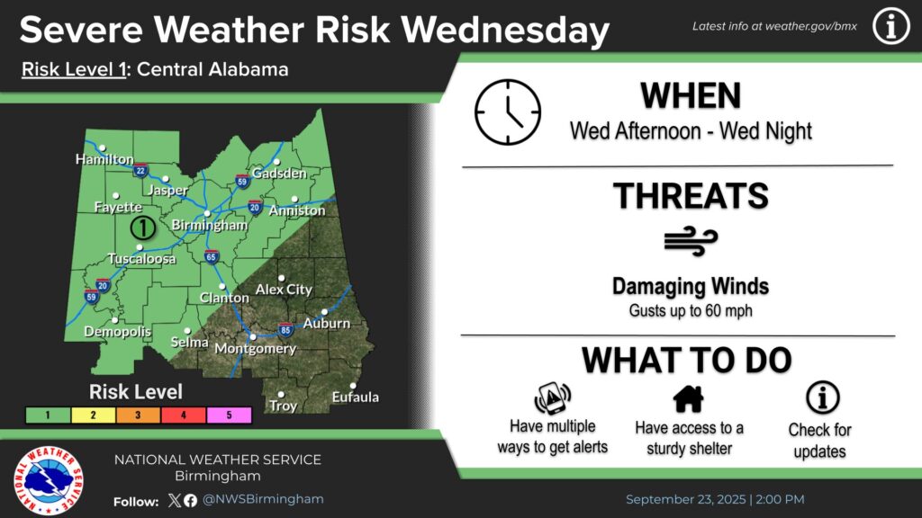
Wednesday’s Risk
On Wednesday, the greatest risk for hazardous weather will be across the northern and western portions of Central Alabama. Storms are expected to develop during the evening and continue into the night. The primary concern is damaging wind gusts that could bring down trees and power lines.
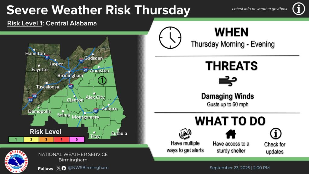
Thursday’s Risk
After a brief lull overnight, forecasters expect storms to redevelop along the boundary late Thursday morning and persist through the evening. On Thursday, the focus shifts to the southern and eastern half of Central Alabama, with damaging winds again the main threat.
While the risk of severe weather is considered low, the National Weather Service cautions that any storm that does strengthen could produce hazardous winds. Residents are encouraged to stay weather-aware, especially during the late-day and evening hours when storms are most likely to occur.
https://weisradio.com/2025/09/23/nws-storms-could-bring-damaging-winds-wednesday-night/


You must be logged in to post a comment.