
Severe Weather Outlook for Today
From the National Weather Service in Birmingham:
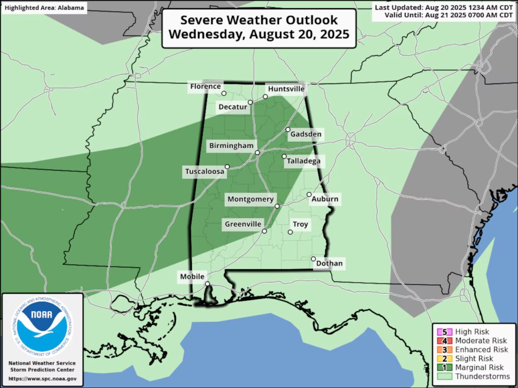
Hazardous Weather Outlook
National Weather Service Birmingham AL
252 AM CDT Wed Aug 20 2025

ALZ011>015-017>050-211100-
Marion-Lamar-Fayette-Winston-Walker-Blount-Etowah-Calhoun-Cherokee-
Cleburne-Pickens-Tuscaloosa-Jefferson-Shelby-St. Clair-Talladega-
Clay-Randolph-Sumter-Greene-Hale-Perry-Bibb-Chilton-Coosa-Tallapoosa-
Chambers-Marengo-Dallas-Autauga-Lowndes-Elmore-Montgomery-Macon-
Bullock-Lee-Russell-Pike-Barbour-
252 AM CDT Wed Aug 20 2025

This Hazardous Weather Outlook is for the counties served by the
National Weather Service office in Birmingham.

.DAY ONE...Outlook through Tonight.

There is a Marginal Risk (Level 1 out of 5) for severe storms across
Central Alabama this afternoon and evening. The main threat is
damaging winds up to 60 MPH.

.DAYS TWO THROUGH SEVEN...Thursday through Tuesday.

No hazardous weather is expected at this time.

.SPOTTER INFORMATION STATEMENT...

Activation of storm spotters and emergency management |may be needed
this afternoon and evening.
You must be logged in to post a comment.