
Flood Watch
National Weather Service Huntsville AL
817 AM CDT Wed Aug 13 2025
…FLOOD WATCH IN EFFECT UNTIL 7 PM CDT THIS EVENING…
* WHAT…Flooding caused by excessive rainfall is possible.
* WHERE…Portions of Alabama, including the following areas, DeKalb, Jackson, Lauderdale, Limestone, Madison and Marshall and southern middle Tennessee, including the following areas, Franklin TN, Lincoln and Moore.
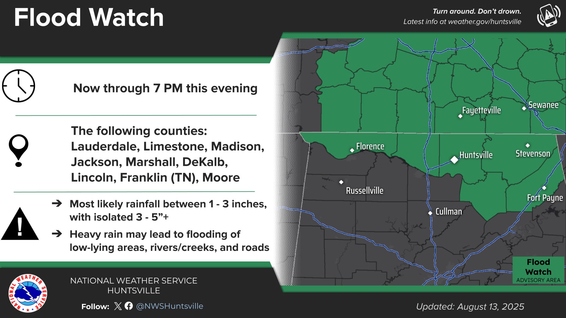
* WHEN…Until 7 PM CDT this evening.
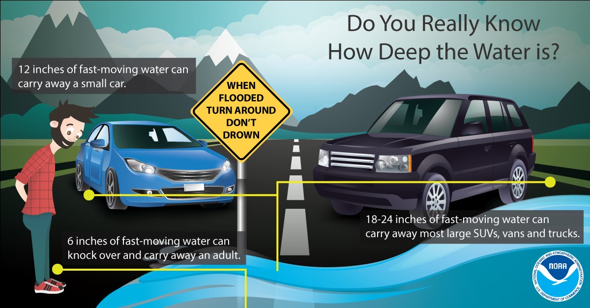
* IMPACTS…Creeks and streams may rise out of their banks. Low-water crossings may be flooded.
* ADDITIONAL DETAILS…
– Several rounds of rain and thunderstorms are expected to impact the Flood Watch area today. With soils becoming increasingly saturated, additional rainfall will quickly be converted to runoff, increasing the risk for flooding.
– http://www.weather.gov/safety/flood
PRECAUTIONARY/PREPAREDNESS ACTIONS…
You should monitor later forecasts and be alert for possible Flood Warnings. Those living in areas prone to flooding should be prepared to take action should flooding develop.


You must be logged in to post a comment.