
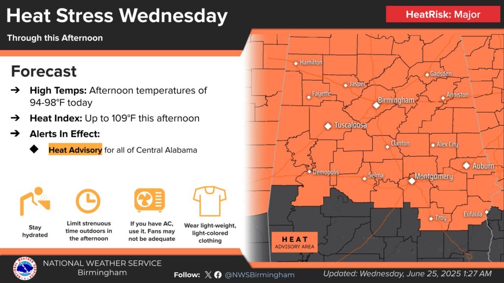
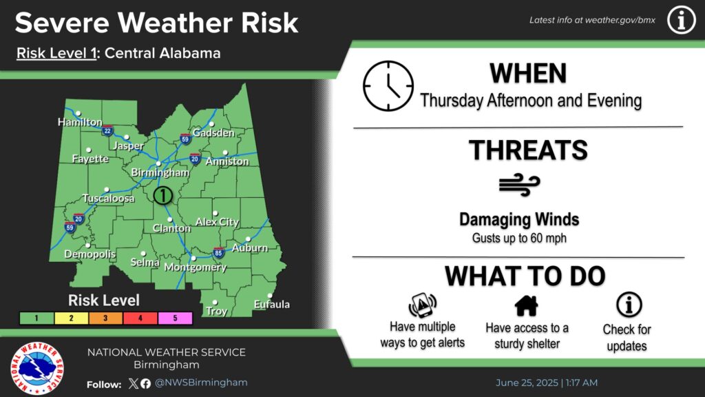
Storms Possible Today and Thursday Amid Extreme Heat From The National Weather Service in Birmingham: HEAT ADVISORY REMAINS IN EFFECT UNTIL 7 PM CDT THIS EVENING... * WHAT...Heat index values up to 108. * WHERE...Autauga, Barbour, Bibb, Blount, Bullock, Calhoun, Chambers, Cherokee, Chilton, Clay, Cleburne, Coosa, Dallas, Elmore, Etowah, Greene, Hale, Jefferson, Lee, Lowndes, Macon, Marengo, Montgomery, Perry, Pickens, Pike, Randolph, Russell, Shelby, St. Clair, Sumter, Talladega, Tallapoosa, Tuscaloosa, Walker, and Winston Counties. * WHEN...Until 7 PM CDT this evening. * IMPACTS...Hot temperatures and high humidity may cause heat illnesses. PRECAUTIONARY/PREPAREDNESS ACTIONS... Drink plenty of fluids, stay in an air-conditioned room, stay out of the sun, and check up on relatives and neighbors. Young children and pets should never be left unattended in vehicles under any circumstances. Take extra precautions if you work or spend time outside. When possible, reschedule strenuous activities to early morning or evening. Know the signs and symptoms of heat exhaustion and heat stoke. Wear light weight and loose fitting clothing when possible and drink plenty of water. To reduce risk during outdoor work, the Occupational Safety and Health Administration recommends scheduling frequent rest breaks in shaded or air conditioned environments. Anyone overcome by heat should be moved to a cool and shaded location. Heat stroke is an emergency! Call 9 1 1.OVERVIEW: * Thunderstorms are expected to develop this afternoon across eastern Alabama and spread westward. Very hot and humid conditions will provide ample fuel for damaging winds with any storms that develop. FORECAST CHANGES: * Expanded the marginal and slight areas to the north and west. HIGHLIGHTS:
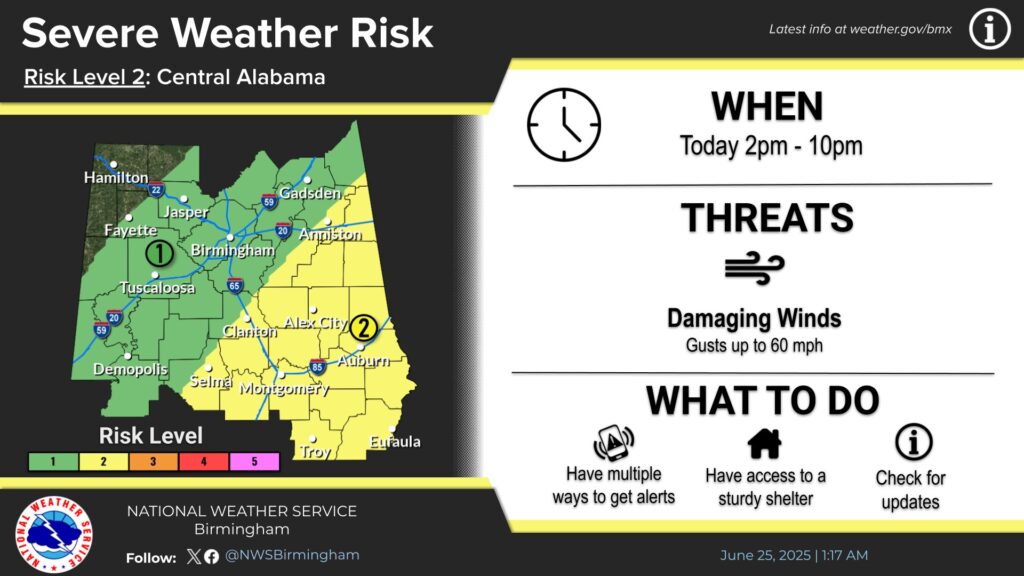
Where:* Much of central Alabama (Slight risk for areas south of I-20,
Marginal Risk for the rest of the area, EXCEPT for the far Northwest)
When:* This afternoon and evening (2pm to 10pm)
Threats:* Damaging Winds


You must be logged in to post a comment.