


Today
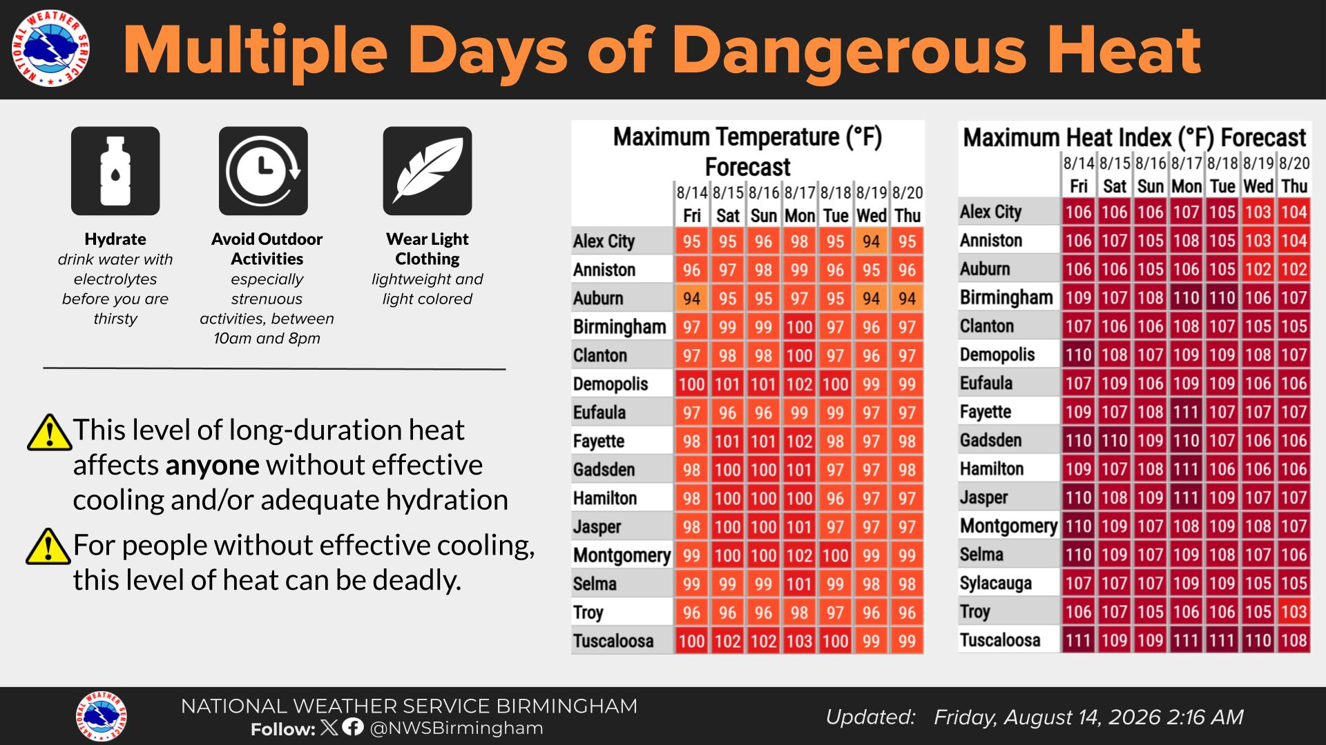
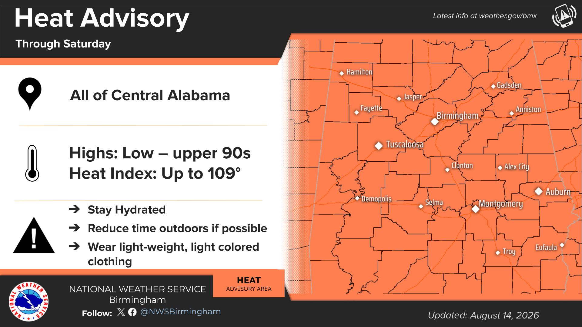
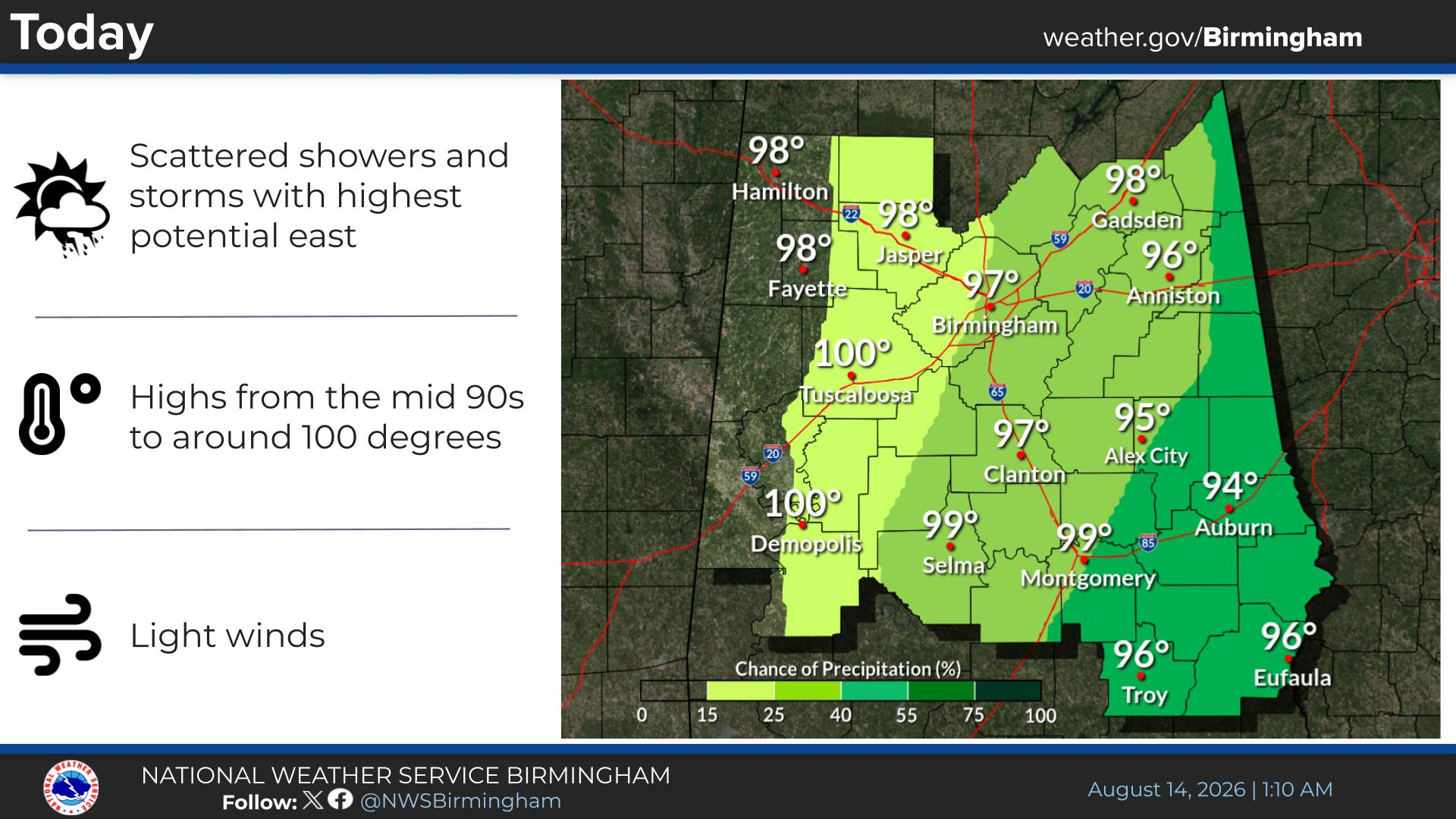
A 40 percent chance of showers and thunderstorms, mainly after 1pm. Mostly sunny and hot, with a high near 98. Heat index values as high as 110. Calm wind becoming west around 5 mph in the afternoon.
Tonight
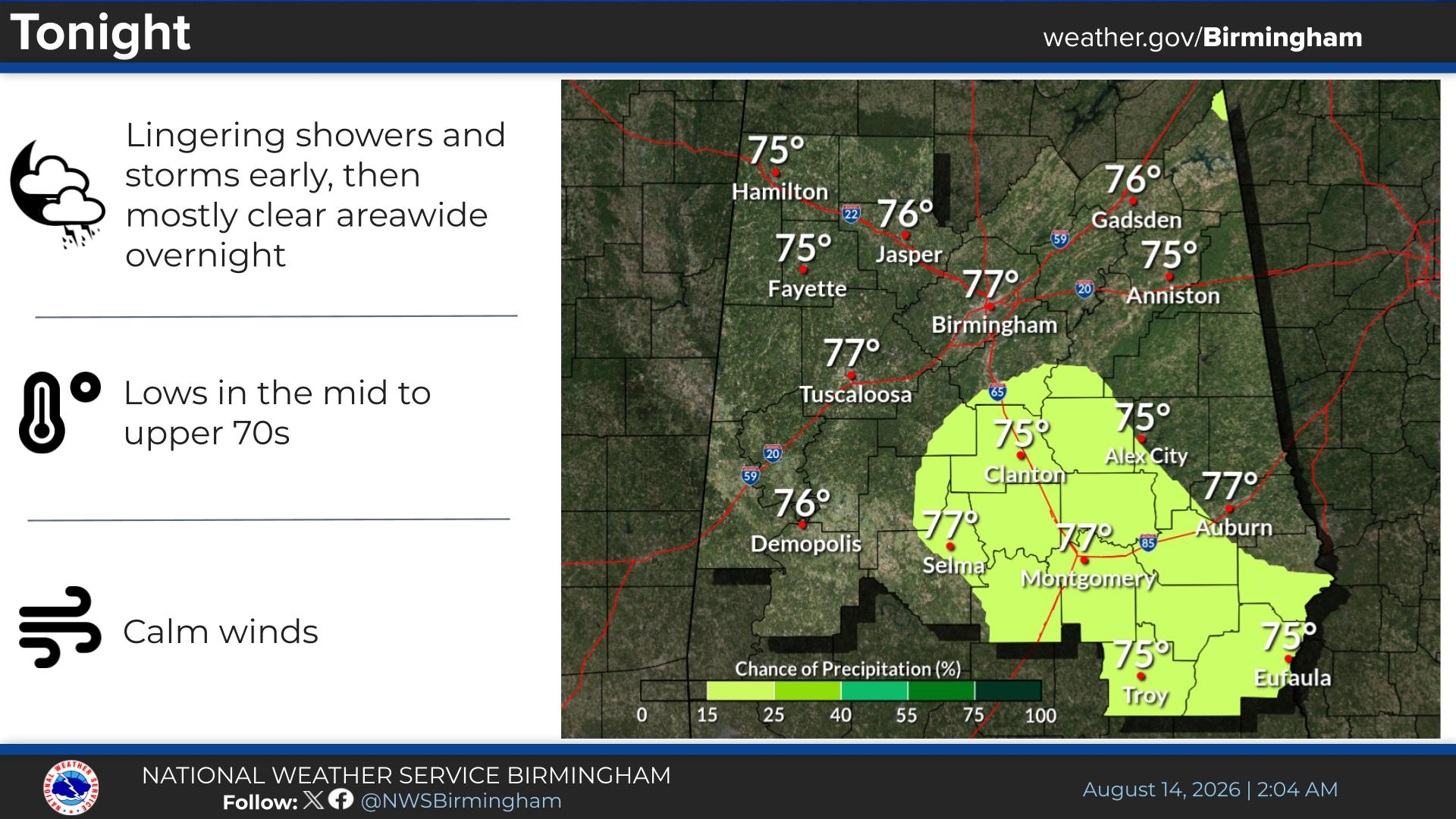
Partly cloudy, with a low around 75. Calm wind.
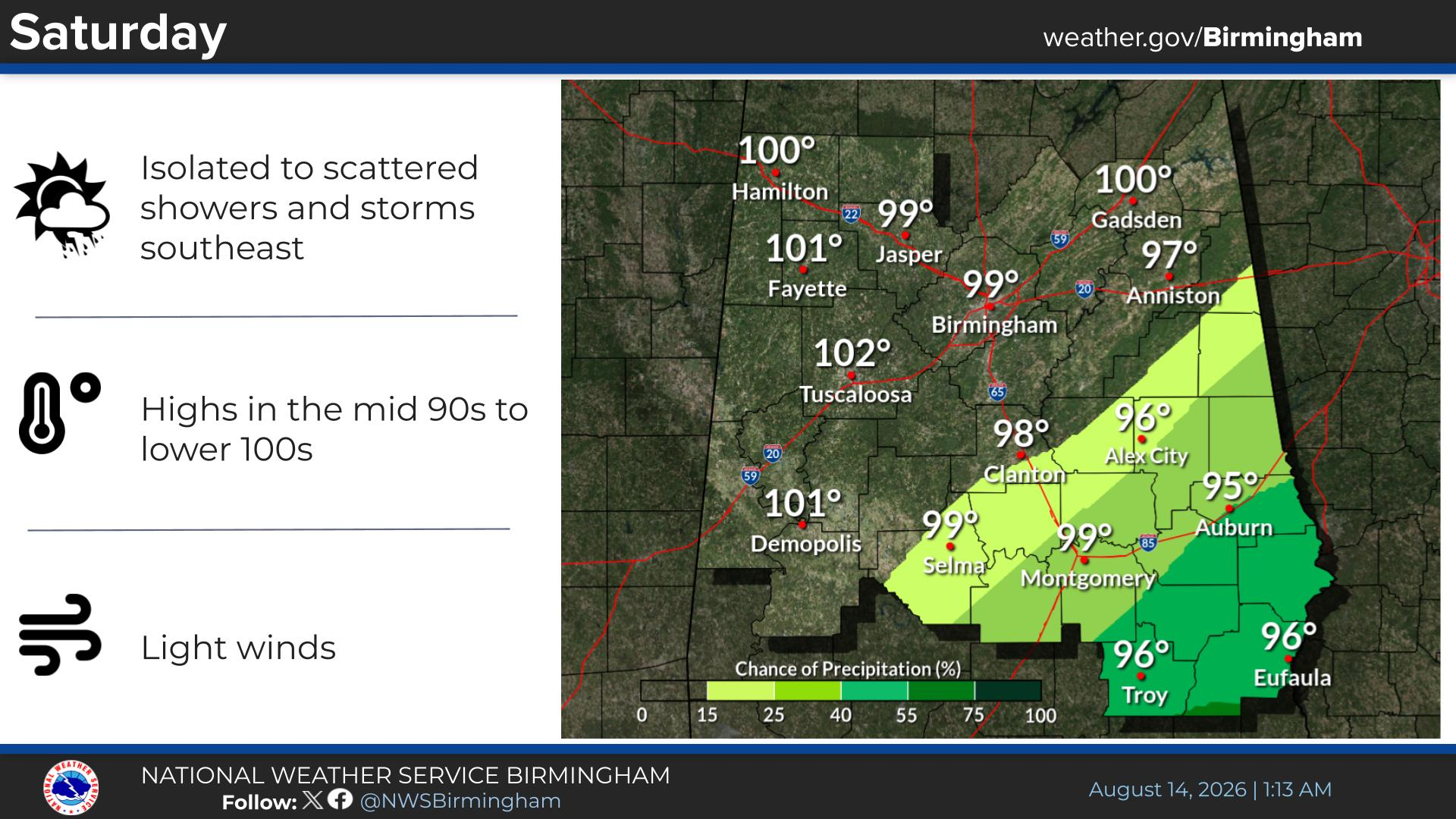
Saturday
Sunny and hot, with a high near 99. Heat index values as high as 110. Calm wind becoming northwest around 5 mph in the afternoon.
Saturday Night
Mostly clear, with a low around 75. Calm wind.
Sunday
Sunny and hot, with a high near 100. Calm wind becoming west around 5 mph in the afternoon.
Sunday Night
Mostly clear, with a low around 75.
Monday
Sunny and hot, with a high near 100.
Monday Night
Mostly clear, with a low around 76.
Tuesday
Sunny and hot, with a high near 97.
Tuesday Night
Partly cloudy, with a low around 73.
Wednesday
Mostly sunny and hot, with a high near 97.
Wednesday Night
Partly cloudy, with a low around 74.
Thursday
A 20 percent chance of showers and thunderstorms. Mostly sunny and hot, with a high near 97.



You must be logged in to post a comment.