
Low Severe Weather Risk Expected This Weekend; Higher Threat Possible Monday
BIRMINGHAM — The National Weather Service in Birmingham is monitoring multiple opportunities for severe weather across Central Alabama over the coming days, including a low-end risk this weekend and a more significant threat early next week.
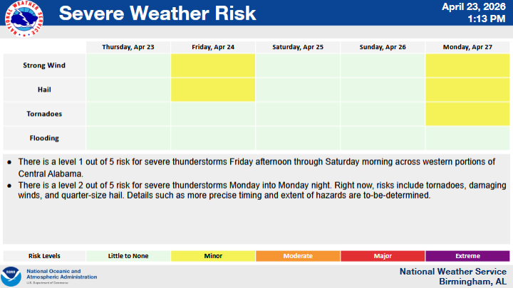
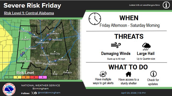
Forecasters have outlined a Level 1 out of 5 risk for severe thunderstorms from Friday afternoon through Saturday morning, primarily affecting the western portions of Central Alabama. This marginal risk indicates that isolated severe storms will be possible, though widespread impacts are not expected at this time.
Attention then turns to Monday, when a Level 2 out of 5 risk — classified as “slight” — has been issued for portions of the region extending into Monday night. This level suggests scattered severe storms could develop, with a greater potential for impacts compared to the weekend system.
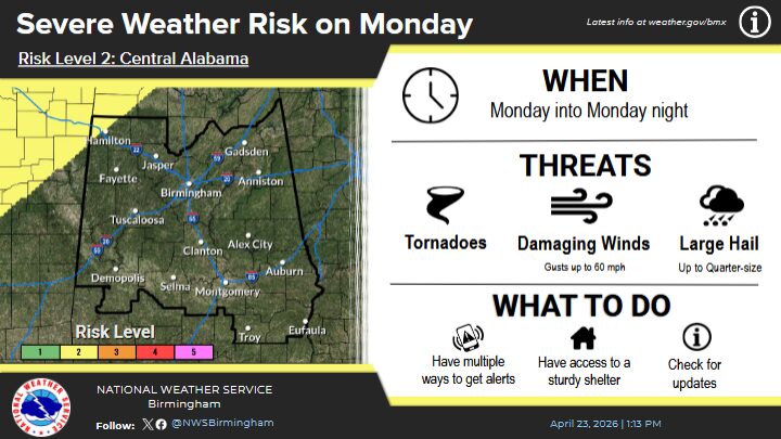
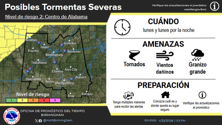
The National Weather Service noted that specific details regarding timing and potential hazards for Monday’s system are still being refined as the event approaches.
Residents are encouraged to stay weather-aware and monitor updates as forecasts become more precise.


You must be logged in to post a comment.