Weather Report — National Weather Service Birmingham
A frontal system is moving across Alabama today, bringing two rounds of thunderstorms to Central Alabama and the potential for severe weather.
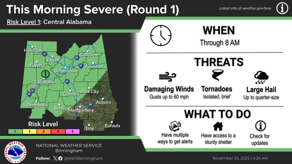
According to the National Weather Service in Birmingham, the first round of storms is already underway and impacting the western and northern portions of Central Alabama. This activity is expected to continue through 8 a.m. Forecasters expanded the coverage area for this initial round due to ongoing development.
A second round of storms is expected to form later this morning and continue into the evening, affecting all of Central Alabama between 7 a.m. and midnight. The NWS maintains a Marginal to Slight Risk—level 1 to 2 out of 5—for severe weather during this period, with timing adjusted based on newer data.
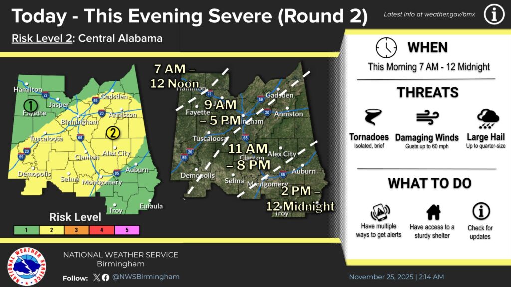
Both rounds of storms may produce damaging winds up to 60 miles per hour, large hail up to quarter size, and the possibility of a brief, isolated tornado or two.
Residents are urged to remain weather-aware throughout the day and monitor updates from the National Weather Service as well as here on WEIS and http://weisradio.com.