

From the National Weather Service in Birmingham:
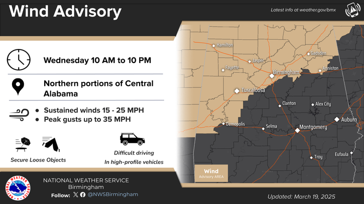
Wind Advisory
URGENT – WEATHER MESSAGE
National Weather Service Birmingham AL
318 AM CDT Wed Mar 19 2025
…WIND ADVISORY REMAINS IN EFFECT FROM 10 AM THIS MORNING TO 10 PM CDT THIS EVENING…
* WHAT…South winds 10 to 20 mph with gusts up to 30 mph expected.
* WHERE…Blount, Calhoun, Cherokee, Etowah, Fayette, Jefferson, Lamar, Marion, St. Clair, Walker, and Winston Counties.
* WHEN…From 10 AM this morning to 10 PM CDT this evening.
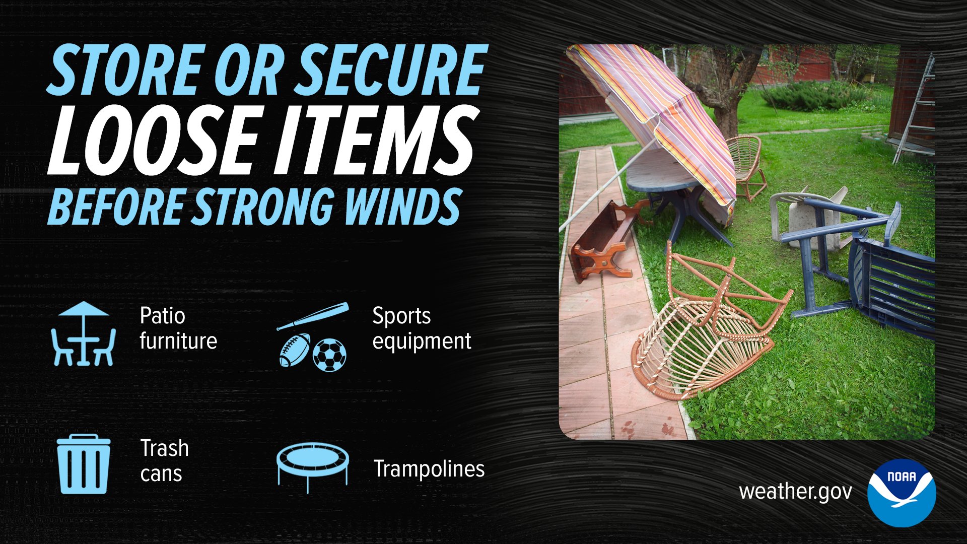
* IMPACTS…Gusty winds will blow around unsecured objects. Trees could be blown down and a few power outages may result.
PRECAUTIONARY/PREPAREDNESS ACTIONS…
Winds this strong can make driving difficult, especially for high profile vehicles. Use extra caution.
Secure outdoor objects.
From the National Weather Service in Huntsville:
Wind Advisory
URGENT – WEATHER MESSAGE
National Weather Service Huntsville AL
736 AM CDT Wed Mar 19 2025
…WIND ADVISORY REMAINS IN EFFECT UNTIL 10 PM CDT THIS EVENING…
* WHAT…South winds 20 to 30 mph with gusts around 45 mph expected.
* WHERE…Portions of north central, northeast, and northwest Alabama and southern middle Tennessee.
* WHEN…Until 10 PM CDT this evening.
* IMPACTS…Gusty winds will blow around unsecured objects. Tree limbs could be blown down and a few power outages may result.
PRECAUTIONARY/PREPAREDNESS ACTIONS…
Winds this strong can make driving difficult, especially for high profile vehicles. Use extra caution.


You must be logged in to post a comment.