
From the National Weather Service in Huntsville:
Flood Watch
Flood Watch
National Weather Service Huntsville AL
1035 AM CDT Fri Mar 14 2025
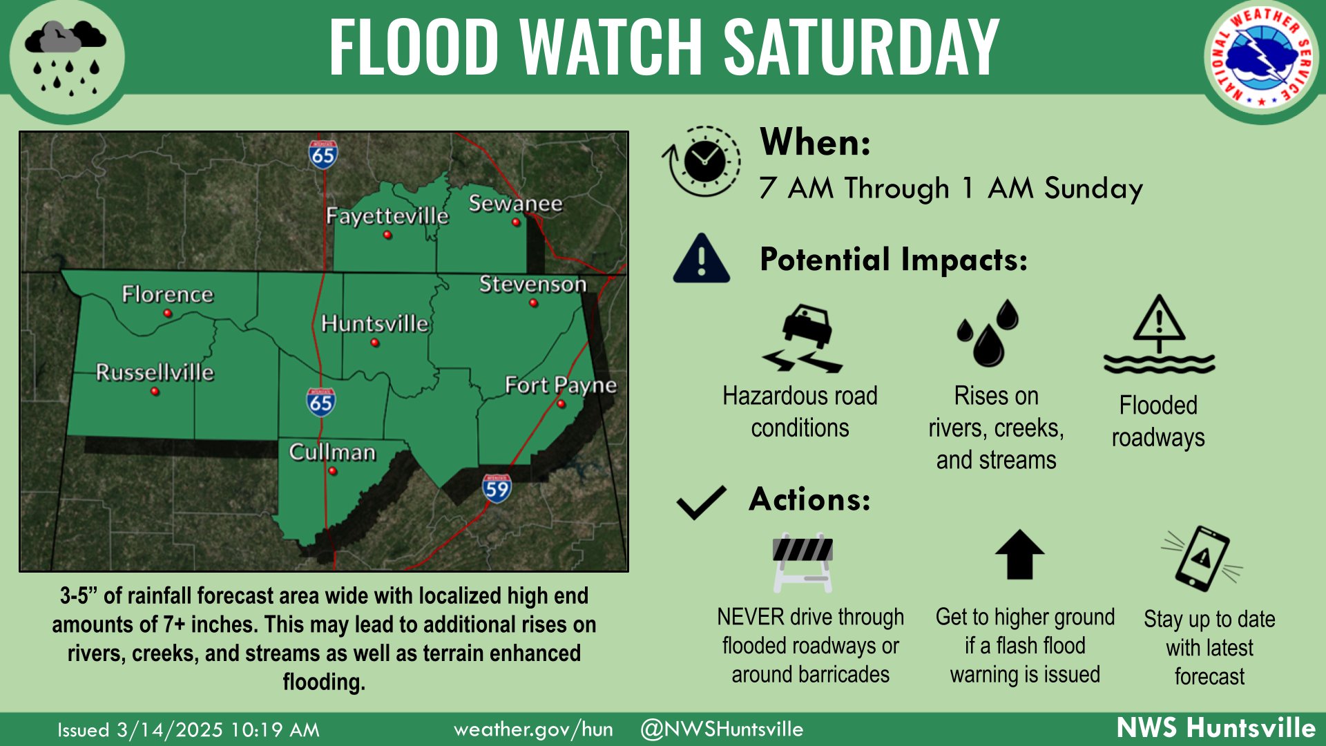
…FLOOD WATCH IN EFFECT FROM SATURDAY MORNING THROUGH LATE SATURDAY NIGHT…
* WHAT…Flash flooding caused by excessive rainfall is possible. Widespread rainfall totals of 3 to 5 inches, with localized higher amounts over 7 inches.
* WHERE…All of northern Alabama and southern middle Tennessee.
* WHEN…From 7 AM Saturday through 1 AM Sunday.
* IMPACTS…Excessive runoff may result in flooding of rivers, creeks, streams, and other low-lying and flood-prone locations. Creeks and streams may rise out of their banks. Flooding may occur in poor drainage and urban areas.
* ADDITIONAL DETAILS…
– Several rounds of thunderstorms will result in widespread rainfall totals of 3 to 5 inches, with localized higher amounts over 7 inches.
– http://www.weather.gov/safety/flood
PRECAUTIONARY/PREPAREDNESS ACTIONS…
You should monitor later forecasts and be prepared to take action should Flash Flood Warnings be issued.
Stay with WEIS 100.5 FM, 990 AM, and the WEIS Radio app for all the latest weather updates.


You must be logged in to post a comment.