Hazardous Weather Outlook
Hazardous Weather Outlook
National Weather Service Birmingham AL
1252 PM CST Tue Mar 4 2025
This Hazardous Weather Outlook is for the counties served by the National Weather Service office in Birmingham.
.DAY ONE…Outlook through Tonight.
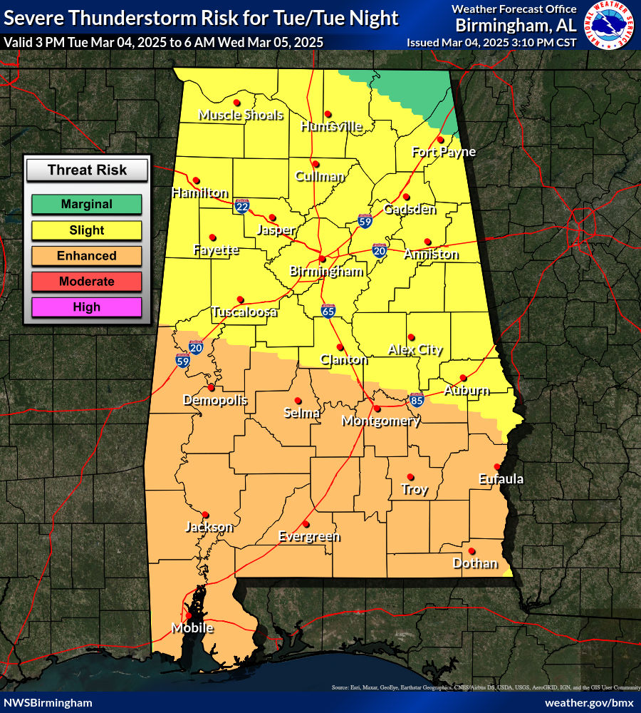
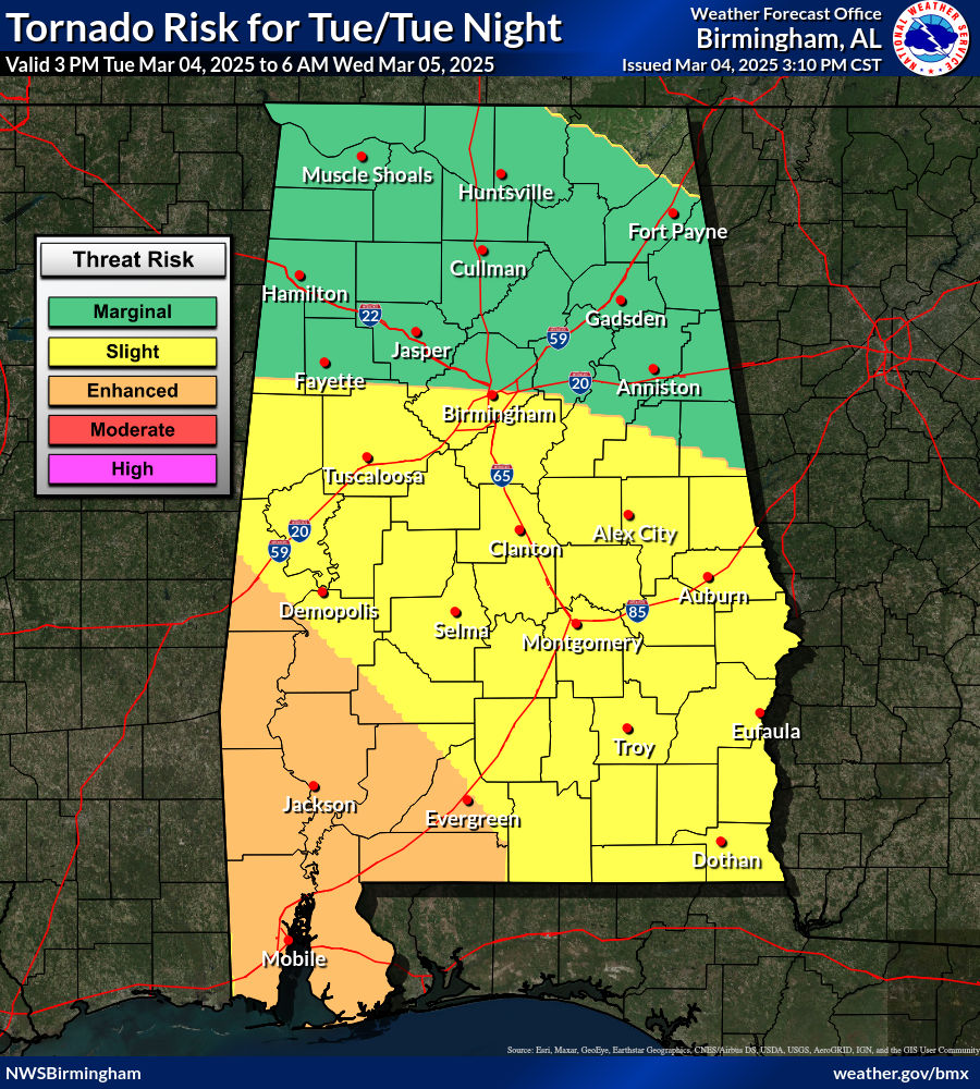
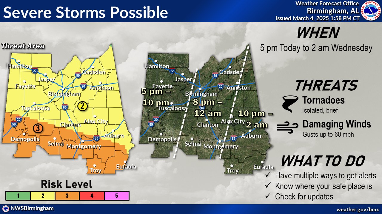
There is a level 2 out of 5 risk for severe storms this evening into early Wednesday morning across all of central Alabama. Threats include damaging straight-line winds and a few tornadoes.
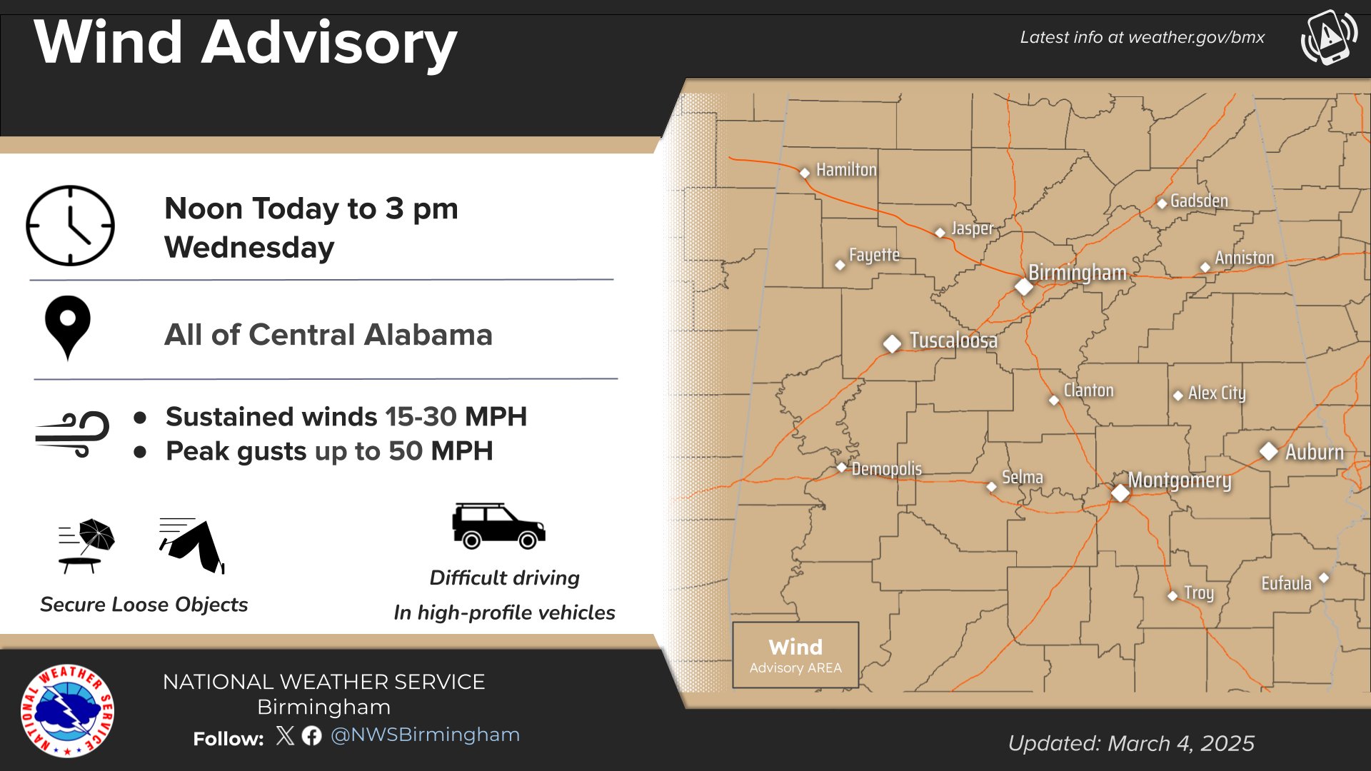
Additionally, a wind advisory remains in effect until 3PM Wednesday. Gradient winds at times may be stronger than the winds associated with the line of thunderstorms.
.DAYS TWO THROUGH SEVEN…Wednesday through Monday.
No hazardous weather is expected at this time.
.SPOTTER INFORMATION STATEMENT…
Activation of storm spotters and emergency management will be needed Tuesday evening into early Wednesday morning.
Stay with WEIS 100.5 FM, 990 AM, and the WEIS Radio app for all the latest weather updates.