
 Flood Watch/National Weather Service Birmingham AL
Cherokee-Cleburne-Clay-Randolph-Tallapoosa-Chambers-Macon-Bullock-Lee-Russell-Pike-Barbour / Including Phenix City, Ashland, Heflin, Alexander City, Troy, Tuskegee, Lanett, Auburn, Dadeville, Opelika, Valley, Centre, Roanoke, Union Springs, Eufaula, and Lafayette
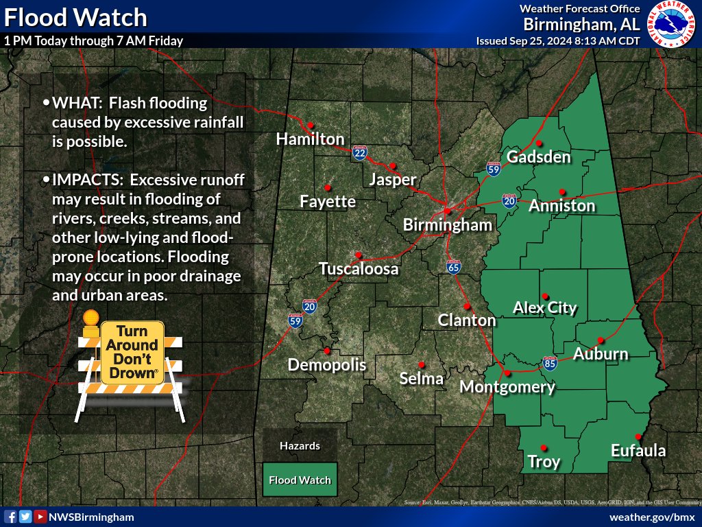
FLOOD WATCH REMAINS IN EFFECT FROM 1:00 CDT THIS AFTERNOON THROUGH FRIDAY MORNING
* WHAT
Flash flooding caused by excessive rainfall continues to be possible.
* WHERE
A portion of central Alabama, including the counties of Barbour, Bullock, Chambers, Cherokee, Clay, Cleburne, Lee, Macon, Pike, Randolph, Russell and Tallapoosa.
* WHEN
From 1:00 CDT this afternoon through Friday morning.
* IMPACTS
Excessive runoff may result in flooding of rivers, creeks, streams, and other low-lying and flood-prone locations.
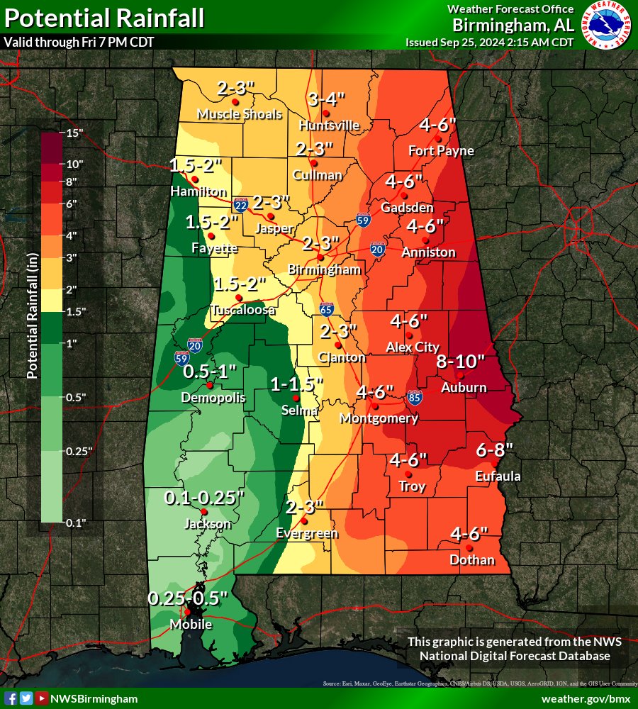
* ADDITIONAL DETAILS
Locally heavy rainfall will begin this afternoon, and it will then become more widespread on Thursday as Helene approaches the area. Rainfall amounts of 4 to 8 inches will be possible, with locally up to 10 inches.
http://www.weather.gov/safety/flood
PRECAUTIONARY/PREPAREDNESS ACTIONS
You should monitor later forecasts and also be prepared to take action if Flash Flood Warnings are issued.


You must be logged in to post a comment.