

Hazardous Weather Outlook/National Weather Service Birmingham AL
Marion-Lamar-Fayette-Winston-Walker-Blount-Etowah-Calhoun-Cherokee-Cleburne-Pickens-Tuscaloosa-Jefferson-Shelby-St. Clair-Talladega-Clay-Randolph-Sumter-Greene-Hale-Perry-Bibb-Chilton-Coosa-Tallapoosa-Chambers-Marengo-Dallas-Autauga-Lowndes-Elmore-Montgomery-Macon-Bullock-Lee-Russell-Pike-Barbour
This Hazardous Weather Outlook is for the counties served by the National Weather Service office in Birmingham.
Outlook through Tonight.
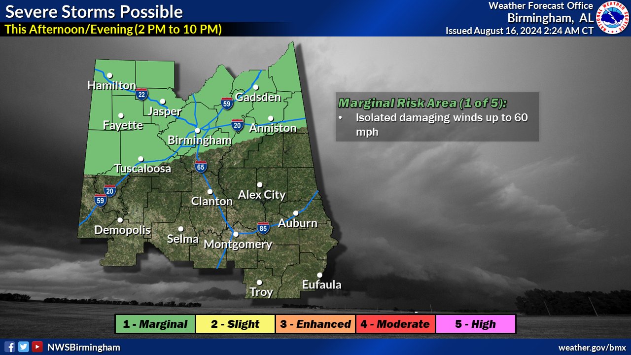
There is a 1 out of 5 risk of severe storms this afternoon and evening, mainly along north of Interstate 20. Threats include damaging winds up to 60 mph.
Saturday through Thursday.
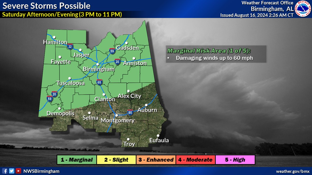
There are 1 out of 5 risks of severe storms during the afternoon and evening hours of Saturday and Sunday across much of Central Alabama –Threats include damaging winds up to 60 mph.
SPOTTER INFORMATION STATEMENT
Activation of storm spotters and emergency management – may become necessary Friday, Saturday, and Sunday.



You must be logged in to post a comment.