
Overview:
An active weather pattern will set up over the holiday weekend as a few disturbances move east over the area – and will trigger both shower and thunderstorm development with most of the activity and greater risk for strong to severe storms occurring during the late morning through the late evening time frame.
Changes from previous forecast:
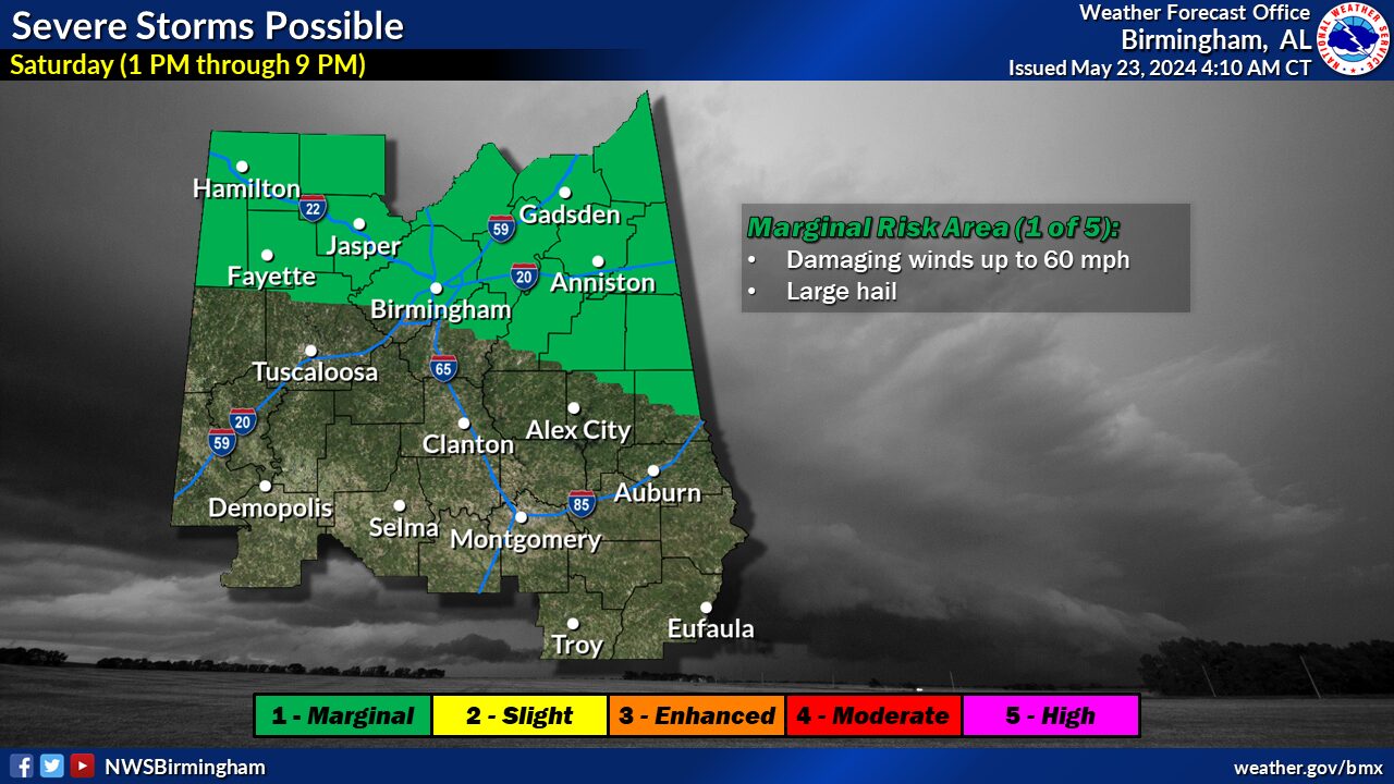
Introduced a marginal (level 1 of 5) risk of severe storms on Friday and Saturday across portions of Central Alabama.
Highlights:
Where:
* Friday generally along and north of a line from Eutaw to Alexander City
* Saturday generally along and north of a line from Millport to Sylacauga
When:
* Friday from 10 am to 10 pm
* Saturday from 1 pm to 9 pm
Threats:
* Damaging winds up to 60 mph
* Large hail up to quarter in size
Additional upcoming threats:
A cold front will approach the area late Sunday into the day on Monday (Memorial Day). There may be some severe storm potential during this time frame as well.
We will have more information to evaluate on this risk over the next few days.


You must be logged in to post a comment.