
Wind Advisory
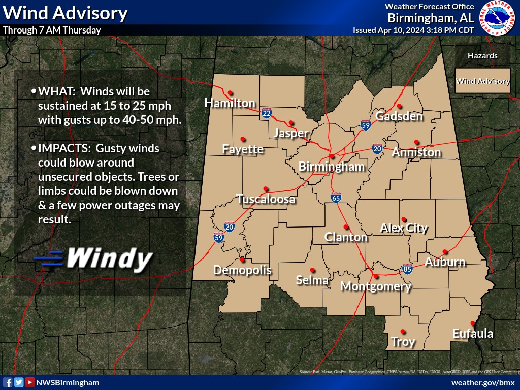
URGENT - WEATHER MESSAGE
National Weather Service Birmingham AL
314 PM CDT Wed Apr 10 2024

ALZ018>021-026>029-036>038-043>050-111200-
/O.EXB.KBMX.WI.Y.0007.240410T2300Z-240411T1200Z/
Etowah-Calhoun-Cherokee-Cleburne-St. Clair-Talladega-Clay-
Randolph-Coosa-Tallapoosa-Chambers-Elmore-Montgomery-Macon-
Bullock-Lee-Russell-Pike-Barbour-
Including the cities of Tallassee, Ashland, Rockford, Alexander
City, Eufaula, Phenix City, Talladega, Montgomery, Sylacauga,
Dadeville, Anniston, Auburn, Roanoke, Wetumpka, Lanett, Tuskegee,
Heflin, Centre, Lafayette, Pell City, Moody, Valley, Opelika,
Gadsden, Troy, and Union Springs
314 PM CDT Wed Apr 10 2024

...WIND ADVISORY IN EFFECT UNTIL 7 AM CDT THURSDAY...

* WHAT...Southeast winds 15 to 25 mph with gusts 40 to 50 mph.

* WHERE...A portion of central Alabama.

* WHEN...Until 7 AM CDT Thursday.

* IMPACTS...Gusty winds will blow around unsecured objects. Trees
  could be blown down and a few power outages may result.

PRECAUTIONARY/PREPAREDNESS ACTIONS...

Winds this strong can make driving difficult, especially for high
profile vehicles. Use extra caution.

Secure outdoor objects.


You must be logged in to post a comment.