

Overview:
A strong storm system will be moving into the Southeast during the day Wednesday with potential for heavy rainfall and severe storms to impact Central Alabama.
Many uncertainties still exist in terms of how the event will actually evolve. However, due to the very dynamic nature of the storm system with deep Gulf of Mexico moisture expected to be in place, the likelihood of severe storms and flooding remains in the forecast, especially across southern portions of the area.
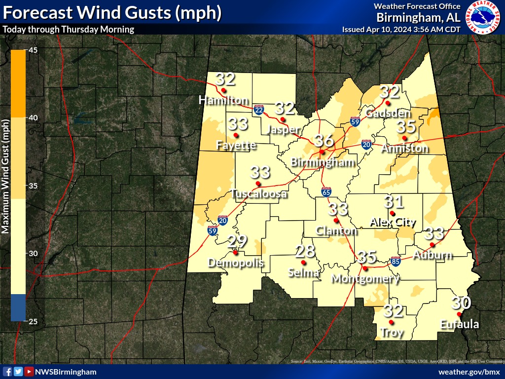
In addition, the gradient winds outside of thunderstorms are expected to gust up to 40 mph Wednesday night through early Thursday morning.
Changes from previous forecast:
* The Enhanced Risk area has been moved to only cover the southwestern and southern counties. The Slight Risk area now runs from Lamar County to Jefferson County to Lee County.
* The ERO Moderate Risk has been updated to include the southern half of Central Alabama.
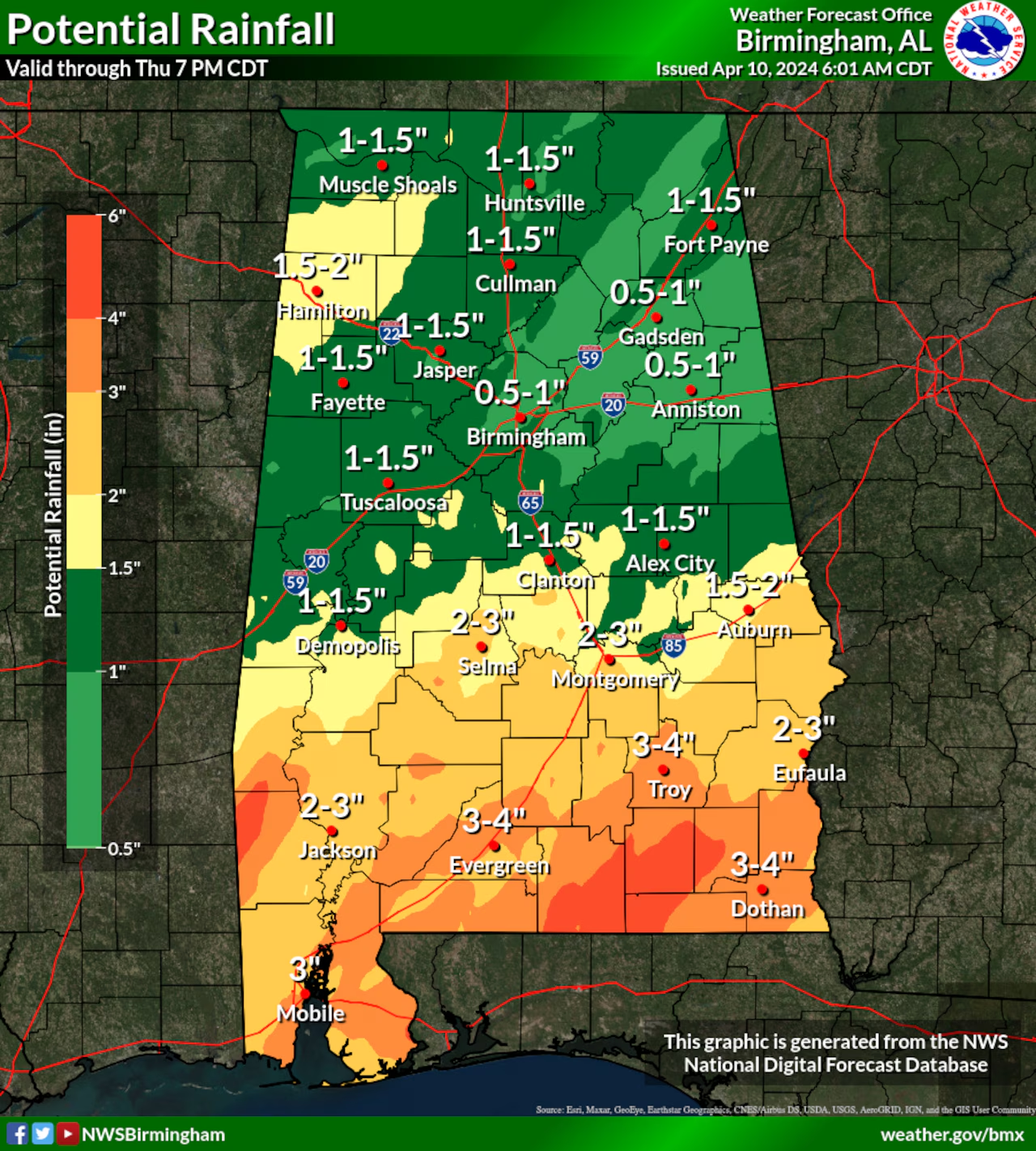
Highlights/Flood Potential:
Where:
* All of Central Alabama
When:
* Wednesday afternoon through Wednesday night
Threats:
* Rainfall amounts of 3 to 4 inches are likely – with isolated higher totals and Potential for flooding and flash flooding where heaviest rainfall occurs
Severe Potential:
Where:
* All of Central Alabama
* Greatest chance across southwestern and southern counties, within the Enhanced Risk area
When:
* Wednesday afternoon through Wednesday night
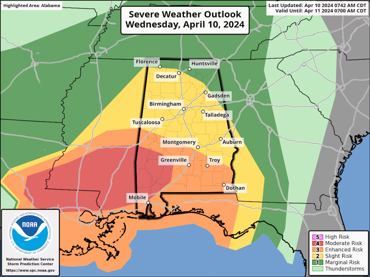
Threats:
* Damaging winds up to 60-70 mph
* Tornadoes
* Quarter size hail


You must be logged in to post a comment.