
Frost Advisory
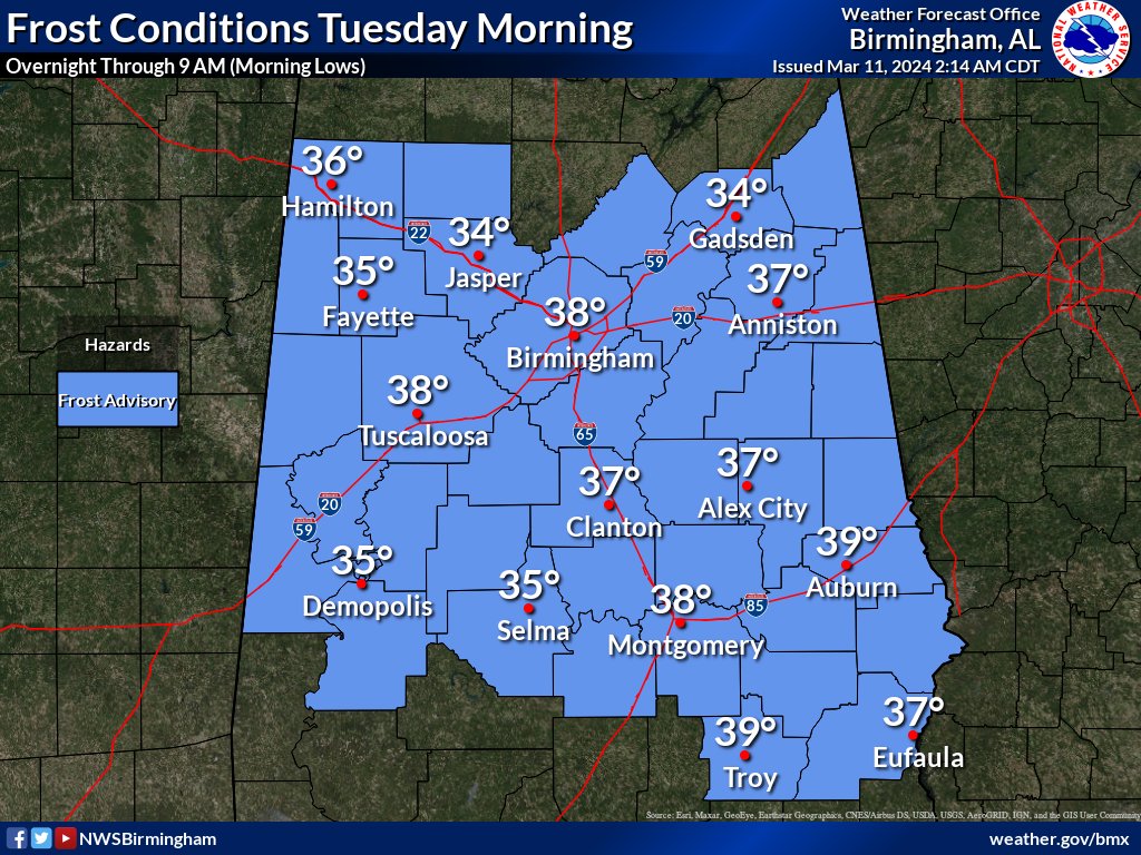
URGENT - WEATHER MESSAGE
National Weather Service Birmingham AL
948 AM CDT Mon Mar 11 2024

ALZ011>015-017>050-112300-
/O.CON.KBMX.FR.Y.0002.240312T0900Z-240312T1400Z/
Marion-Lamar-Fayette-Winston-Walker-Blount-Etowah-Calhoun-
Cherokee-Cleburne-Pickens-Tuscaloosa-Jefferson-Shelby-St. Clair-
Talladega-Clay-Randolph-Sumter-Greene-Hale-Perry-Bibb-Chilton-
Coosa-Tallapoosa-Chambers-Marengo-Dallas-Autauga-Lowndes-Elmore-
Montgomery-Macon-Bullock-Lee-Russell-Pike-Barbour-
Including the cities of Double Springs, Greensboro, Centreville,
Eufaula, Valley, Linden, Gadsden, Montgomery, Fort Deposit,
Sylacauga, Tallassee, Dadeville, Hoover, Oneonta, Livingston,
Prattville, Clanton, Centre, Lafayette, Moundville, Sulligent,
Fayette, Heflin, Pell City, Tuscaloosa, Anniston, Jasper,
Talladega, Eutaw, Wetumpka, Lanett, Hamilton, Columbiana, Moody,
Vernon, Alabaster, Rockford, Union Springs, Opelika, Roanoke,
Alexander City, Selma, Birmingham, Demopolis, Marion, Ashland,
Phenix City, Carrollton, Hayneville, Troy, Tuskegee, Auburn, and
Pelham
948 AM CDT Mon Mar 11 2024

...FROST ADVISORY REMAINS IN EFFECT FROM 4 AM TO 9 AM CDT TUESDAY...

* WHAT...Lows in the mid 30s will result in frost formation.

* WHERE...All of central Alabama.

* WHEN...From 4 AM to 9 AM CDT Tuesday.

* IMPACTS...Frost could harm sensitive outdoor vegetation. Sensitive
  outdoor plants may be killed if left uncovered.

PRECAUTIONARY/PREPAREDNESS ACTIONS...

Take steps now to protect tender plants from the cold.


You must be logged in to post a comment.