
WEATHER UPDATE issued THURSDAY MORNING
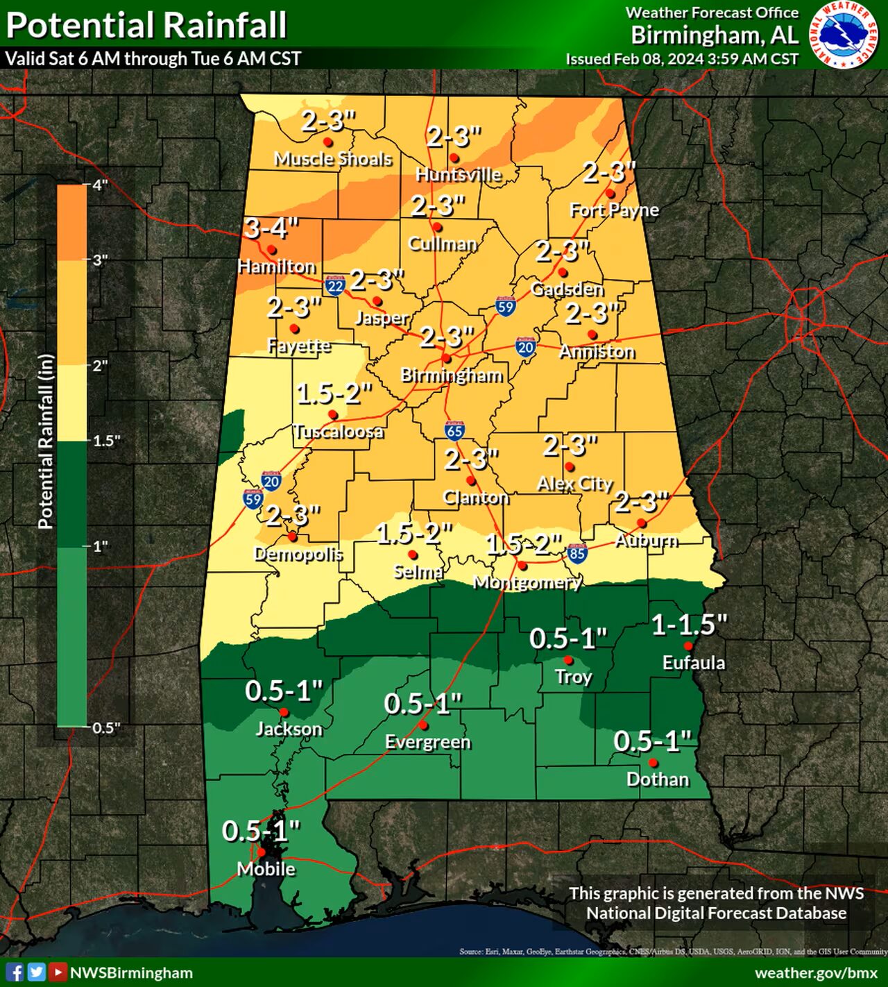
Overview: A period of continuous and sometimes heavy rainfall is set to develop this weekend as a cold front stalls across the Tennessee Valley.
The highest rainfall amounts, ranging from 2 to 4 inches – are forecast to accumulate across the northern portion of Central Alabama – and locally higher amounts could result in isolated flash flooding. Additionally, another wave of heavy rain will move across the area on Monday and that could result in additional flooding concerns for a larger portion of Central Alabama.
We’ll continue to assess flooding potential on that end as we get closer.
Changes from previous forecast: Introduced a risk of excessive rainfall, which could lead to flash flooding.
Highlights:
Where:
* Mainly areas north of Interstate 20.
When:
* Saturday into early Sunday morning.
Threats:
* Rounds of heavy rainfall may lead to isolated flooding.


You must be logged in to post a comment.